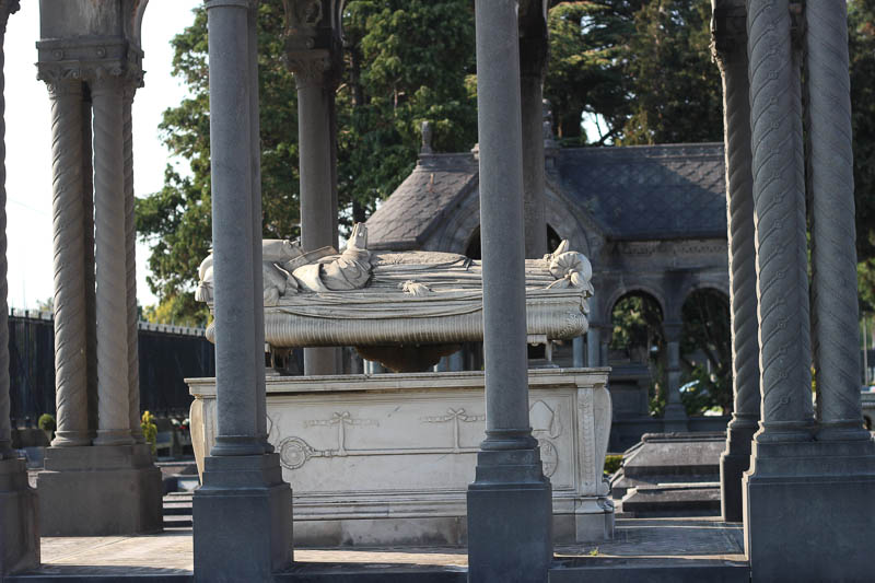
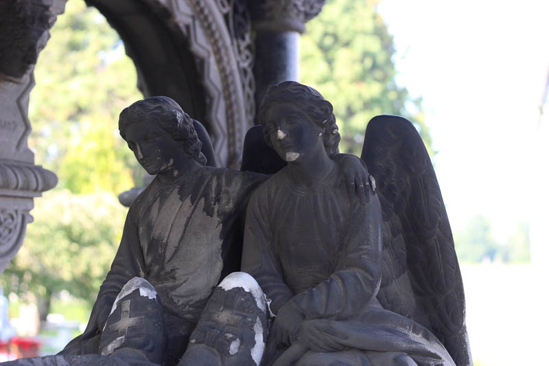
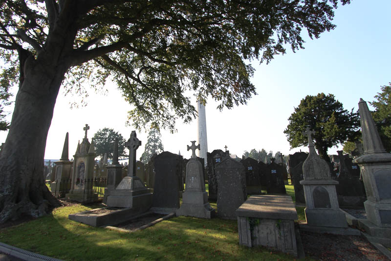
Glasnevin Cemetery – Memories in Stone
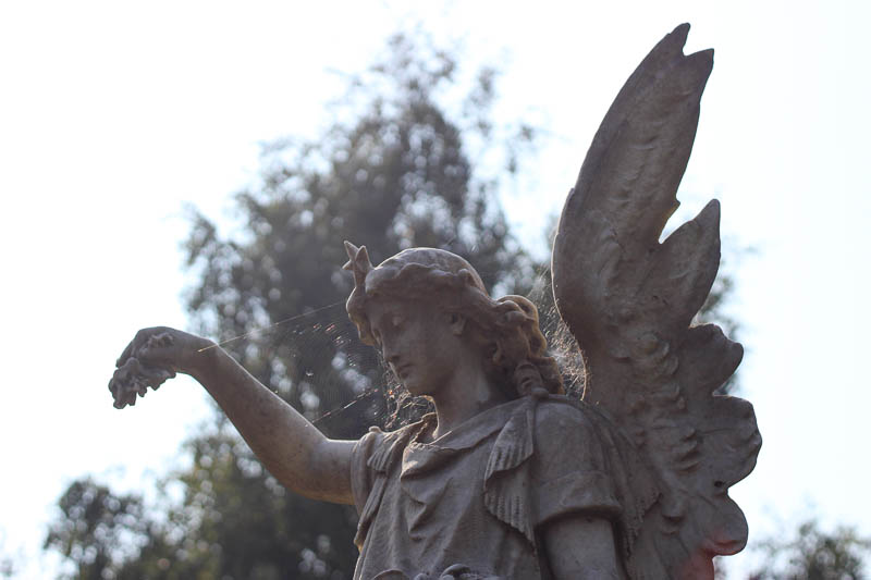
Some believe that stones and trees hold on to the memories of a place. I believe that’s true. The stones in Glasnevin Cemetery in Dublin go on forever. Over 1.5 million people have been buried there since its establishment in 1832, and the markers tell the story of Irish. I went to Glasnevin for those stories. I stayed and was overcome by the art and power of the stones.
Here is a short video featuring some of these remarkable stones.
Glasnevin was established after Daniel O’Connell got legislation passed that allowed Catholics to practice their burial rites and traditions in public. Prior to this, Catholics were oppressed and the “penal laws” prohibited them from the public practice of religious ritual. At Glasnevin, Protestants and Catholics were buried in one place. There was even a place for stillborn children, or children who died before being baptized.
When I planned my trip to Glasnevin, I intended to see the graves of Michael Collins, Eamon de Valera, Brendan Behan, Maud Gonne and Constance Markievicz. My friend Kathy and I spent hours there … not looking for certain graves, but simply looking at grave after grave, stone after stone. The craftsmanship and art in preserving memories and marking places of importance is overwhelming. One loses track of time.
Glasnevin is a thin place.
If you plan a visit to Glasnevin, be prepared to walk and give yourself enough time to wander, to think, to get inside the memories that marked here in gardens of stone that go on forever.
Boa Island and Caldragh Cemetery – the Janus Figure

The Janus Figure in Caldragh Cemetery
This two faced Janus figure has been watching the sun rise and set over Boa Island for several thousand years. He’s about four feet high and is perched in a lumpy, ancient cemetery in County Fermanagh – Caldragh Cemetery.
Boa Island is a small island off the shores of Lough Erne, and Caldragh is a place of high earth energy. There is little known about this figure – referred to as the Janus figure because like “Janus” the Roman god with two faces, this figure has a front and …. well … a front. What you see in this image to the left is one side. The other side is also a front view with a face (see image below).
Locals found a piece of stone nearby that apparently used to serve as a base for this figure which would have made the Janus figure more life size when it was originally carved. No one knows exactly how old the figure is, or where it came from or what it means.
There is much speculation.
The Lusty Man

The Lusty Man – Caldragh Cemetery
Near the Janus figure is a smaller, shorter figure that has a similar, sort of heart shaped face. But this little guy only has one face and appears to only have one eye – sort of blinded in his left eye. He is referred to as “the Lusty Man” ..not for any reason to do with lust or sensuality, but because he was found sitting all by his lonesome self in a marshy field on nearby Lusty Beg Island. He was relocated to Caldragh cemetery to keep him protected in a proper setting.
The two figures are anchors on this ancient burial ground. They stand above the ruts and lifts and random stones that mark now-forgotten dead. There is a remarkable presence in this untidy cemetery.
Caldragh is mystical
The cemetery has amazing energy that draws people to it, even though it is one of the hidden sacred places not often found in the guidebooks. If thin places are places where we are more in tune with God and eternal world, then Caldragh is paper thin.

Caldragh Cemetery – Boa Island
Boa Island is one of several island in Lough Erne, but it is connected to the mainland by a a causeway and single road that runs from one end to the other. It is off this road that a marker sign subtly identifies the cemetery. The word caldragh was often assigned to Irish cemeteries that were not consecrated ground (by the Christians). These cemeteries were might be pagan, or places where unbaptized people or outsiders were buried. It certainly has that forgotten feel, but forgotten like a misplaced loved one, whose soul calls out to be found.
The moment a visitor steps into this space the energy vibrates. The Janus figure watches from every direction. Maura Brooks, a psychic medium and Reiki healer from Tyrone visited Caldragh Cemetery and used a pendulum to test the energy coming from the Janus figure and the Lusty Man. She writes …

Caldragh Janus Figure – side 2
Using a pendulum, the Janus figure swung anti clockwise, while the Lusty Man pulled it clockwise. (In energy terms, anti clockwise opens an energy, while clockwise direction closes it). Last time I was there, the cows in the nearby field starting mooing very loudly as I used the pendulum – almost as though they too, could feel the energy opening. And a large white feather fell out of the sky, even though there were no birds around.
Tracing the thin places path – “how did you get here?”
Thin places are places where we are more in-tune to God, the God of the Universe, the one loving creator that binds people of all faiths, all souls together into one connected family. Thin places lead us to truth, wisdom and purpose. But sometimes it’s hard to figure out what we’re supposed to learn of be led to.
Five steps for Traveling to Thin Places
Use these five keys for traveling to thin places. They unlock insights.
- Trace the route that brought you to the thin place. How did you get there? How did you hear about this place? Who led you there?
- Notice the signs as you enter. Sometimes things you see or encounter as you approach or enter a site will have meaning later.
- Take in the details. Look at the borders. Study with your five sense. Be still, don’t move. Just notice the details.
- Record your memories during or soon after the visit. In a journal write down the answers or notes from keys 1, 2, and 3. Also note how you feel, what you sense apart from your five senses. Write the date and time you were there. Record the names and details of key people you met or encountered at the site.
- Build your internal gateway at home. Store all related materials, notes, photos, mementos (items taken from the site) and anything else related to the site in one place. These items can help you return to that thin place internally when you want to revisit it and draw on the spiritual energy there.
May your spirit soar as you experience thin places.
Rathcroghan – Royal Site in Tulsk – County Roscommon

Guest blogger for this post is Mike Croghan, owner of Rathcroghan Tours. He’s from Bellanagare in County Roscommon. Mike is an artist as well as a guide will be leading our group through the Rathcroghan sites on day 6 of the Thin Places 2012 tour.
A Croghan on Rathcroghan
I’m the luckiest man in the world – I really am, I’m a Croghan and I live on Rathcroghan.
To those who may not have heard of Rathcroghan (that would be 99.9% ), it is one of Ireland’s greatest hidden gems, a landscape that is both physical and mystical, the Tara of the west, home to the goddess Medb, the epicenter for Celtic spirituality……and more.
I clearly remember sitting at the window looking over at a nearby hill whilst eating my dinner – I was 7 years old. What had my attention was a ring fort on the hill top, I can remember wondering what it was before turning my attention back to the spuds.
 Approaching one of the Rathcroghan mounds.
Over 40 years later I still wonder about that ring fort, what was it used for, why was it placed there, who lived there; my problem is that I am asking the same question about the other 140 monuments on Rathcroghan and it has taken over my life. You see Rathcroghan has the highest density of earthworks in Europe and they sit on the landscape, untouched in their original state teasing me with their enigmatic presence.
The monuments are wrapped in myths and legends, some are named after long dead kings or heroes, others hold the secrets to the otherworld, more have names associated with ancient tales and stories.
For the archaeologist Rathcroghan is a gold mine of monuments dating from as far back as the Neolithic period all the way through the bronze age, iron age, right through the medieval periods to today, so many different styles of monument – raths, cairns, barrows, ring forts, ceremonial mounds, caves and standing stones.
If you approach Rathcroghan as a spiritual pilgrim looking for a connection then you have hit the mother load. The integrity of this landscape has remained intact over the millennia as have the energies within the land. In fact the area only really makes sense when viewed as a ritual landscape.
 View from one of the Rathcroghan mounds
While other Celtic capitals hit the headlines and receive thousands of visitors each year Rathcroghan sits and waits for the inquisitive pilgrims to search it out, allowing only the true path walker to find it, this may sound poncy but it really is true.
The greatest thrill for me is to be able to introduce these seekers to the area and let them see for themselves just how special the area is, as I said, I’m the luckiest man in the world.
And I still love the spuds.
 Mike Croghan – Rathcroghan Tours
Learn more about Rathcroghan at Mike’s website – Rathcroghan Tours. His website includes some video and audio with photographs and text. It’s a great resource for those wanting to know more about this remarkable complex of sites.
Corcomroe Abbey – Monastic Ruins in The Burren
County Clare is one the most visited areas on tours of Ireland, and the Burren is a worthy destination for any traveler to the West. The Poulnabrone Dolmen, ring forts and the moonscape look of the Burren are what most people see in photos and guidebooks on Ireland. But the mystical ruins of Corcomroe Abbey are an equally important Burren landmark. This sacred ground compels the visitor to be quiet, devoted, contemplative … almost as is if the long-gone inhabitants were still there.

Originally, Corcomroe was a Cistercian abbey, set in the valley surrounded by the Burren’s barren hills that look as if all the grass and vegetation were scraped off with jagged glass. The abbey was built sometime in the late twelfth century. Access to the valley was through a pass in the mountains known as the “monks pass, ” and it was part of a fortified region guarded by a castle (now long gone).

The fishbone pattern on the ribs that support the vaulted roof over the sanctuary, the effigy of a Chieftain king, the smiling bishop carved into a crumbling wall, carved faces and flowers resembling bluebells atop the large columns are all part of what makes Corcomroe amazing.
Corcomroe is a place to walk through slowly… to stop and notice the details.

The Abbey sits just off one of the main roads that wind through the Burren. It’s easy to explore and has a strong sense of solitude. The backdrop of the mountains and small green fields still enclosed by abbey stone walls add to the solitude of Corcomroe. It has a haunted presence.
Corcomroe projects its memories into the landscape and onto the pilgrim.

The setting is a perfect mingling of this world and the eternal world – the past and the present. Looking at the old ruins immediately draws the visitor into a rich past, but the new roof protecting a portion of the abbey is a contribution of today’s faithful – people who want to protect it and preserve it. …a community that values and cherishes it.

Corcomroe shrine secured on the outside wall.
What’s left of Corcomroe is a historical spiritual remnant kept company by the local village’s faithful departed. Graves are everywhere. But so are little hints and reminders of today’s faithful who come to pray, reflect and tend to the memories. Their presence is seen in the repaired grave slab, a makeshift cross, a new flower bed or a small shrine like the one pictured above. This plastic virgin Mary is secured into a concrete base. She was placed on the outer wall with three lavender silk roses and a glass jar. Coins left by devotees are both in the jar and at her feet. I took this photo in September of 2009. I returned to Corcomroe in May of 2011. The shrine was gone.
Corcomroe is a thin place. It’s a lonely place.
Timoleague – Mystical Ruin on the Sea

Timoleague Abbey Ruin – County Cork
Along the road between Kinsale and Clonakilty, near Courtmacsherry is the village of Timoleague which is dominated by the great seaside abbey ruin, a remnant of a 13th century Franciscan Friary. The abbey is built on the site of a former monastery founded by St. Molaga in the 7th century. Timoleague means – “house of Molaga.”
St. Molaga, as the story goes was a local boy who went to study the rule of St. Columba in Iona and then went on to Wales where he became good friends with St. David. He returned to Ireland and founded several monastic communities, but Timoleague was his greatest – and his last. He died here – probably of the plague. He and his followers were committed to helping those suffering from the disease when the plague hit Ireland in the late 7th century.
A story is told about how St. Molaga originally wanted to build his monastery farther up the estuary. But as he and his followers labored on the buildings by day, they all collapsed by night. St. Molaga took this as a sign that the Lord did not approve of the location. So he blessed a candle, lodged it in a rolled up sheath, set it alight and released it on the bay praying that God would help him find the perfect location for his new religious community. The candle floated until it stopped at the where the Timoleague ruin now stands. St. Molaga built his monastery on the sea and six hundred years later the Franciscans built an abbey on the foundations of St. Molaga’s monastery. The ruins of that monastery are what visitor’s see today.
I found this thin place through the recommendation of Mr. Noel O’Connor who was my host at Ashgrove Bed and Breakfast in Bandon. Over breakfast I asked him, “What is the most mystical place around here?” He was caught off-guard and hesitated. As a forma garda (police officer) I suspect he wasn’t invited to discuss “mystical” or thin places often. After pausing to give it some thought, he told me that many pilgrims go to Timoleague to pray and reflect. So I took his advise and I went to Timoleague.
What remains is a beautiful ruin now made into a comfortable public space on the scenic Courtmacsherry Harbor. When the monastery was active, boats used to sail right up to abbey, and the village grew around the activities focused there. Past the picnic tables and the stone wall are bones of the old religious house with haunting traces of how life existed there so many years ago.

The Cloister Garth at Timoleague
Two favorite spaces for me were the dining room and the cloister walk. Pictured above is the cloister garth the part of a corner wall still standing. Monasteries typically had these square cloister walks with an open court-yard type garth in the center. The walks were the center of the the cloister and often used for doing “rounds” or walking and praying in a circular path. The walls bordering the garth had gothic-style windows to look out. I love to trace the steps of those who once walked and prayed here. On account I read said that at one corner of the walk the incorrupt body of a monk buried centuries before was discovered. He was reinterred on the grounds.
Another peaceful spot here is the refectory or dining area. It’s a large rectangular room off the back of the ruin with five tall windows (frames still in tact) looking out over the sea. Next to this area is a cavity wall, with indentations known as the fairy cupboards. It was from this room that children discovered an ancient book buried under one of the flagstones. They destroyed it and only the shred of the cover was found.

Cavity wall – the “fairy cupboards” In the distance is the tower of the Catholic Church
In the sacristy is the ancient holy water font, now known as the Wart Well. It is said to heal warts when those afflicted dip the warts into the water.
The monastery was sacked in the 1600s and three monks escaped by boat and took with them the Timoleague chalice for safe keeping. It was discovered in an old box in a home in the village many years ago and is now held by one of the priests residing in Timoleague.
In the distance behind the ruin a round tower (new) can be seen atop a church. This is the Catholic Church dedicated to the Nativity of the Blessed Mother. One of Henry Clark’s last stain glass masterpieces can be found here.
Timoleague is a haunting site full of mystery and charged with the energy of the past. It is one of the stops on the Thin Places Mystical Tour of Ireland in May of 2011.

The Wart Well at Timoleague
Holy House of ivied gables
That wert once the country’s pride
Houseless now in weary wandering
Roam your inmates far and wide
~from Lament Over the Ruins of the Abbey of Timoleague
John Collins -1814
Skibbereen Famine Cemetery – a thin place
 Abbeystrewery Cemetery in Skibbereen. 8000 – 10,000 victims of the Great Hunger are buried here.
Skibbereen was a hub of commerce in southern Ireland during the nineteenth century, with the River Ilen flowing through the town ending at the Baltimore Harbour near the Atlantic Ocean. But Skibbereen is perhaps most famous for its association with the Great Famine that hit Ireland hardest in 1846-47. The song Skibbereenwith a haunting melody and lyrics that tell of a father recounting to his son the cruel reason why he left his beloved homeland “old Skibbereen,” – he lost the farm, the house, and he lost his wife to hunger when the boy was but 2 years old. So the father fled with the young son wrapped in his coat – never to return for fear of being imprisoned for the debt he owned in taxes and rent. County Cork was one of the areas in Ireland that lost over one third of its population to the Famine in those years.
History states that the Famine occurred because of a failure in the potato crop in Ireland. The Irish were under British occupation at the time. Rich landlords controlled the country, though they were a small portion of the population. Most of the population served as tenants to these landlords, and suffered from high rents and taxes. Poverty ran deep in the tenant class, which used the potato as the main staple of its diet. When the crop failed, panic set in. The Irish sold what they had, including boats and fishing equipment to feed their suffering families. One in three people died in the area surrounding Skibbereen. Most concur that there was plenty of food in Ireland – plenty enough to feed the starving citizens. But the food was exported for profit that was made by the British government and the Anglo Irish ruling class.
 Sketch by illustrator James Mahony entitled – Skibbereen 1847 – Mahony produced this for a London newspaper in the same year
People were dying so fast in Skibbereen that there weren’t enough people alive to take care of the task of burying the dead. So a mass grave was dug near the ruins of the old Abbeystrewery Franciscan friary. It is estimated that 8,000 to 10,000 nameless, coffinless, unremembered dead were dumped into the mass grave. Today the lumpy plot of ground has green grass covering the burial site and a stone marker that says:
In Memory of the Victims of the Famine 1845-48
Whose Coffinless Bodies were Buried in this Plot
There is a commemorative Famine trail that begins at the town center and includes the Skibbereen Heritage Centre and the Abbeystrewery Cemetery (pictured above). The artistic renderings of stone cutters and poets that dapple the cemetery grounds with tokens of remembrance are worth a trip to Skibbereen. So much sorrow here. One can’t helped but be moved.
Skibbereen is a thin place. And it is a stop on our Thin Places Tour in September 2010.
Kilshannig – The North Side of Dingle Littered with Bones
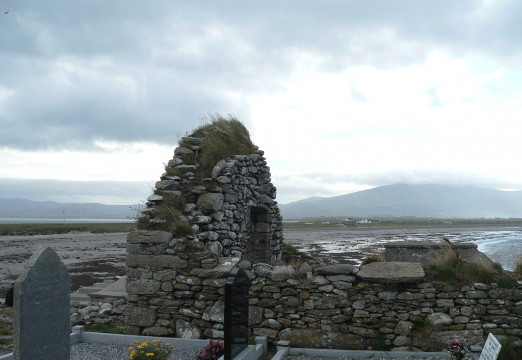
Church Ruin sitting on Brandon Bay in Kilshannig
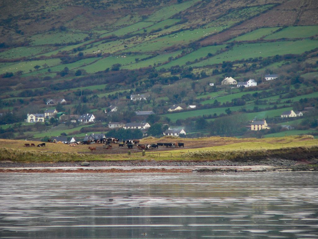
One of the few places in Ireland I can photographically remember is Kilshannig, a small dilapidated village on the Dingle peninsula at its northernmost point. Most visitors that spend a day or less in Dingle seldom visit the northern route which has spectacular sea views, beautiful sandy beaches and commanding perspectives of Mount Brandon.
Just past Castlegregory is the turn-off to go out toward Rough Point. Kilshannig is a hilly village with a few small houses and narrow roads. We found cows wandering freely on the roadside and most of the buildings looked vacant. St. Senan or Seanaigh built a monastery in the Magharee Islands just off the coast of this village in the 7th century that was accessed by sea. A 15th century (some say earlier) church ruin now occupies the site at the edge of village overlooking Brandon Bay and the Atlantic Ocean. This little church was the mainland church for the monastery on the island.
7th Century Cross Slab – Kilshannig
Inside the church walls is cross-pillar slab from the 7th century. It has a Greek style cross carved on it and has been white washed. There are similar carvings on pillar slabs in Glencolmkille in County Donegal. It’s believed that the slabs were part of a pagan ritual before the area was Christianized. This may have served as a wayside marker. No one really knows for sure what these standing stones represented.
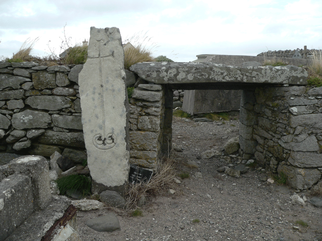
What a remarkable experience to add one’s own hands to the collection of thousands that have traced the engraved path of the cross on that ancient stone.
Cary Meehan, author of A Traveller’s Guide to Sacred Ireland writes:
“In the graveyard is a cross pillar with a fine incised cross with expanded terminals and a double spiral at its base, similar to those at Kilfountain, Kilmalkedar, and Reask.”
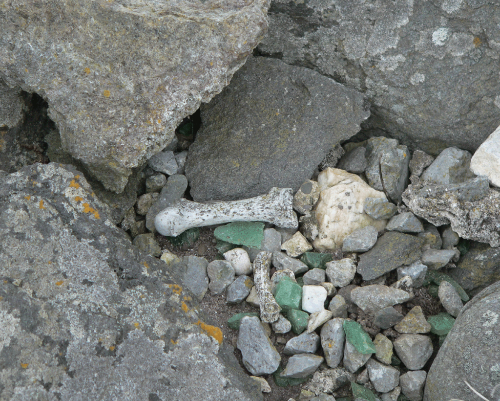
Graveyard is Being Reclaimed by the Sea – Bones Everywhere
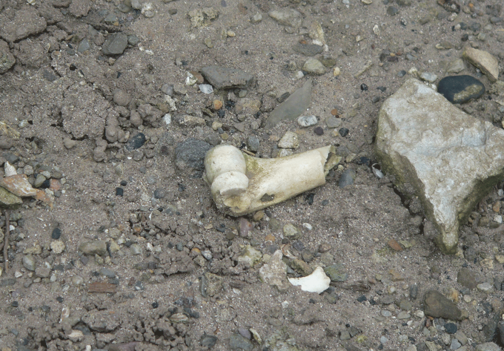
The ruined church was converted to a cemetery as were most of the church ruins in Ireland. And though the church was built on high ground above the sea, Brandon Bay has occasionally eclipsed the banks and invaded some of the old graves. Bones have washed out of the graves and litter the area in and around the church. While it was a somewhat macabre site for us, it was also a reminder that our remains join all the elements of nature eventually. We all return to dust.
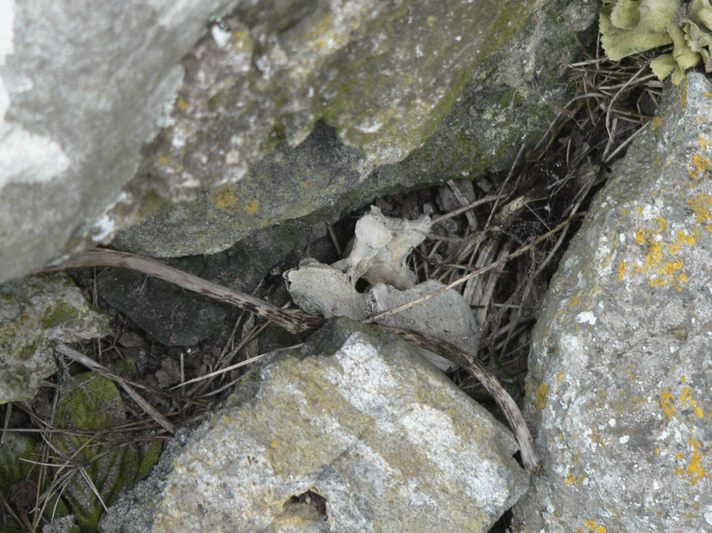
We found some interesting green chards scattered in one place. They had no sharp edges, either glass shards worn down by the sea or some type of stone.
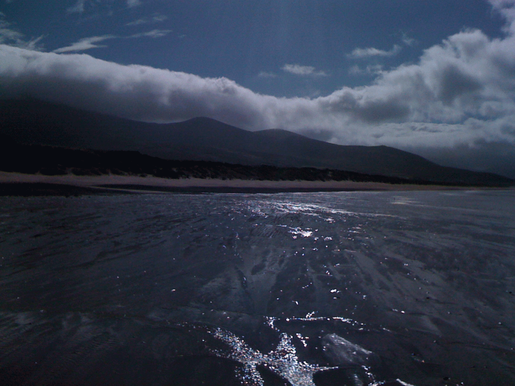
The views from Kilshannig are spectacular. Mount Brandon dominates the western view with Brandon Bay lapping up on a shoreline that extends nearly a half mile out to sea. In the distance, the crashing waves of the Atlantic Ocean can be seen and heard. The silence of the village – save for the wind and sea – is almost eerie. This is a holy place.