In the Irish Game of Thrones – Brian Boru Won
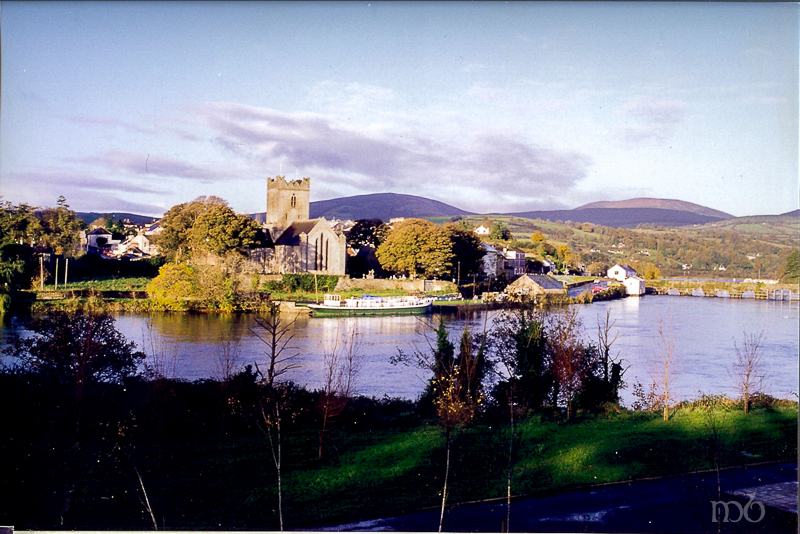
Killaloe – home of Brian Boru – County Clare
The story of Brian Boru, High King of Ireland, plays out like the popular HBO television series Game of Thrones. In the late tenth century, Ireland had about 500,000 inhabitants and 150 kings. It was an old land – a land of tribes and chieftains constantly battling for power and control. No man, woman or child was spared the gruesome, bloody scenes that come with constant war.
Brian Boru was one of eleven sons born to a chieftain who ruled over Thomond, a region covering most of north Munster. He died when Brian was just ten years old. They lived in County Clare in an area now known as Killaloe, a small village on the River Shannon. Being the son of chieftain, Brian was trained as a warrior and he saw more than his share of violence, torture, injury and death. When the local clans weren’t warring, the Vikings were invading. Though Brian grew up to become a great warrior and leader, he also developed superb political skills. These skills paired with his love for Ireland pushed him to become the most successful leader of his time.
At an early age, Brian was ruling Thomond. By the time he was 35 he had ascended to the royal seat of Munster, Ireland’s southwestern province. The High Kings of Munster ruled from the Rock of Cashel , but some historians believe that Brian chose to rule from Kincora, his estate in Killaloe. Brian fathered many sons with several wives, one of whom was a Viking. But as much he traveled throughout Ireland battling and politicking, his home base was always at Kincora. Today, the ramparts of his castle there are still visible in a wooded area off an unmarked path in Killaloe.
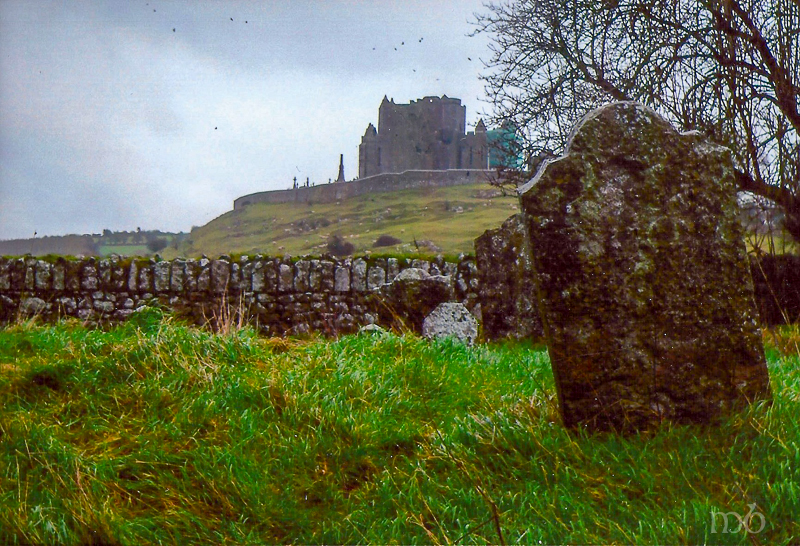
Rock of Cashel – Seat of Munster Kings
Brian Boru Becomes High King in 1002
As in the Game of Thrones where rulers of the seven kingdoms seek the Iron Throne, Brian Boru sought the position of High King. He achieved it when he was 61 years old. Ireland has had many High Kings, but Brian was the only High King who united the entire country for one common cause – to defeat the Norse invaders.
On Good Friday, April 23, 1014, Brian Boru and his sons led an army in a battle at Clontarf near Dublin. There was great loss of life including Brian’s son and grandson, but the 73 year old High King survived. His army defeated the Vikings, driving them into the sea back to their Nordic homelands.
While Brian had a few domestic enemies who ultimately joined the Vikings in battle against him, the Irish masses were behind the High King. And it was this unified spirit that enabled Brian Boru to lead the effort that expelled the Vikings for good. His political savvy, warrior strength and unrelenting determination brought Ireland to a place where the people were united, liberated and poised to grow as a nation.
Brian Boru was undoubtedly the most successful king in Ireland’s history.
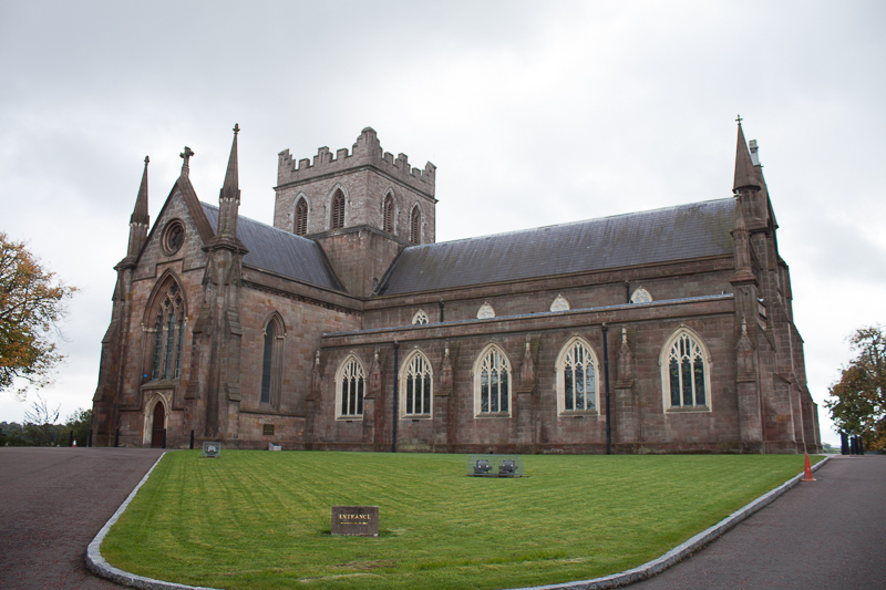
St. Patrick’s Cathedral in Armagh
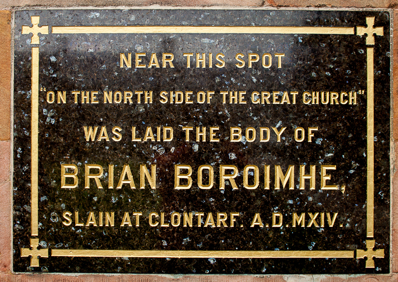
Brian Boru and Sons are Buried at Armagh Cathedral
When the Battle of Clontarf was over and the Norse were driven out into the sea, Brian Boru’s army collected its dead and tended to its wounded while the High King returned to his tent alone, to rest. At some time during the night several fleeing Norseman came upon Brian’s tent and found him alone and vulnerable. They assassinated him.
Brian Boru’s warriors carried his body from Clontarf all the way to Armagh, the Christian capital of Ireland. The High King was buried on the grounds of St. Patrick’s church with the bodies of his son and grandson who had died in the battle. Today St. Patrick’s Cathedral stands where the old church stood. On its outside wall, a marble engraved sign reminds Cathedral visitors that Brian Boru was was laid to rest on the north side of the great church.
Today – April 23rd marks the 999th anniversary of the Battle of Clontarf and Brian Boru’s death.
902 Years and a Day Later
Sadly, after Brian died the country fell back into anarchy with warring tribes and clans vying for power. That unity under Brian Boru was never achieved again by the Irish people – not until 902 years and 1 day later when on Easter Monday, April 24, 1916 the Irish started a unified rebellion that eventually won 26 of Ireland’s 32 counties independence from Great Britain.
*
NOTE: The story of Brian Boru is beautifully told in The Lion of Ireland by Morgan Llywellyn. I highly recommend reading it before taking a trip to Ireland. It has so much history in it. When you visit knowing that history the landscape comes alive.
What is a Thin Place? Mike Croghan Answers
Mike Croghan who runs Rathcroghan Tours gave some beautiful commentary when we asked him “What is a Thin Place?” The 2:57 video below is part of that response (more to follow in another post).
Rathcroghan is the ancient royal capital of Connacht. It’s landscape is covered with mounds and stones and lines of energy. Mike was our private guide for the Rathcroghan site on the Thin Places tour of the West in 2012.
The wind was bit loud in the video, so a transcript of what Mike said is written below the video.
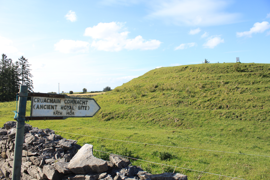
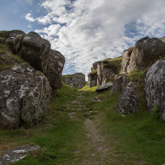
Entrance to Rathcroghan
Transcript of Mike Croghan’s commentary:
A thin place, as you know yourself, is a very loose term .. for a place that would allow people to make a connection. It could be a place between the earth and the vaults of the skies. It could be a place between the earth and the Other world.
It’s a place where the deities and the people of the Other world at special times of the year can make their way through into our realm, but also, at that same time it’s an opportunity for us to travel to the Other world. And it’s a time where you can make a direct connection with the people of the Sidhe, the people of the mounds, the ancestors.
There are a few people, a few special people who have the ability to do this wherever. For the majority of us, a thin place is an opportunity to to make that connection in a certain geographical location.
Here in Ireland we have so many thin places. We have countless thin places. The specific one that I will always mention to people is Oweynagat – the Cave of the Cats – here on Rathcroghan. It’s known as the entrance to Mother Earth. It’s known as the entrance to the Other World. And that really would really be – let’s call it an axis mundi which is a pivotal point between our world and the Other World.
Just to sum it up, a thin place is a place where you can make a connection, and a lot of the time it’s in a specific geographical location. Like I say here it might be the Cave of the Cats. It could be Keshcorran over in Sligo. It could be on Tara. It might be Uisneach. It might be one of the four royal capitals.
It’s a different place for different people.
What I would say to people out there is that if they go looking for thin places, you might find it on a map. You might just find it in your own personal space – wherever you do ritual… wherever you work.
Join us on a tour of thin places.
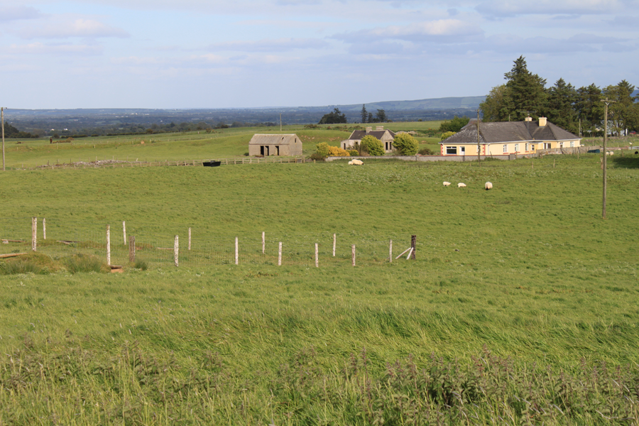
View from one of the Rathcroghan mounds
Boa Island and Caldragh Cemetery – the Janus Figure

The Janus Figure in Caldragh Cemetery
This two faced Janus figure has been watching the sun rise and set over Boa Island for several thousand years. He’s about four feet high and is perched in a lumpy, ancient cemetery in County Fermanagh – Caldragh Cemetery.
Boa Island is a small island off the shores of Lough Erne, and Caldragh is a place of high earth energy. There is little known about this figure – referred to as the Janus figure because like “Janus” the Roman god with two faces, this figure has a front and …. well … a front. What you see in this image to the left is one side. The other side is also a front view with a face (see image below).
Locals found a piece of stone nearby that apparently used to serve as a base for this figure which would have made the Janus figure more life size when it was originally carved. No one knows exactly how old the figure is, or where it came from or what it means.
There is much speculation.
The Lusty Man

The Lusty Man – Caldragh Cemetery
Near the Janus figure is a smaller, shorter figure that has a similar, sort of heart shaped face. But this little guy only has one face and appears to only have one eye – sort of blinded in his left eye. He is referred to as “the Lusty Man” ..not for any reason to do with lust or sensuality, but because he was found sitting all by his lonesome self in a marshy field on nearby Lusty Beg Island. He was relocated to Caldragh cemetery to keep him protected in a proper setting.
The two figures are anchors on this ancient burial ground. They stand above the ruts and lifts and random stones that mark now-forgotten dead. There is a remarkable presence in this untidy cemetery.
Caldragh is mystical
The cemetery has amazing energy that draws people to it, even though it is one of the hidden sacred places not often found in the guidebooks. If thin places are places where we are more in tune with God and eternal world, then Caldragh is paper thin.

Caldragh Cemetery – Boa Island
Boa Island is one of several island in Lough Erne, but it is connected to the mainland by a a causeway and single road that runs from one end to the other. It is off this road that a marker sign subtly identifies the cemetery. The word caldragh was often assigned to Irish cemeteries that were not consecrated ground (by the Christians). These cemeteries were might be pagan, or places where unbaptized people or outsiders were buried. It certainly has that forgotten feel, but forgotten like a misplaced loved one, whose soul calls out to be found.
The moment a visitor steps into this space the energy vibrates. The Janus figure watches from every direction. Maura Brooks, a psychic medium and Reiki healer from Tyrone visited Caldragh Cemetery and used a pendulum to test the energy coming from the Janus figure and the Lusty Man. She writes …

Caldragh Janus Figure – side 2
Using a pendulum, the Janus figure swung anti clockwise, while the Lusty Man pulled it clockwise. (In energy terms, anti clockwise opens an energy, while clockwise direction closes it). Last time I was there, the cows in the nearby field starting mooing very loudly as I used the pendulum – almost as though they too, could feel the energy opening. And a large white feather fell out of the sky, even though there were no birds around.
Tracing the thin places path – “how did you get here?”
Thin places are places where we are more in-tune to God, the God of the Universe, the one loving creator that binds people of all faiths, all souls together into one connected family. Thin places lead us to truth, wisdom and purpose. But sometimes it’s hard to figure out what we’re supposed to learn of be led to.
Five steps for Traveling to Thin Places
Use these five keys for traveling to thin places. They unlock insights.
- Trace the route that brought you to the thin place. How did you get there? How did you hear about this place? Who led you there?
- Notice the signs as you enter. Sometimes things you see or encounter as you approach or enter a site will have meaning later.
- Take in the details. Look at the borders. Study with your five sense. Be still, don’t move. Just notice the details.
- Record your memories during or soon after the visit. In a journal write down the answers or notes from keys 1, 2, and 3. Also note how you feel, what you sense apart from your five senses. Write the date and time you were there. Record the names and details of key people you met or encountered at the site.
- Build your internal gateway at home. Store all related materials, notes, photos, mementos (items taken from the site) and anything else related to the site in one place. These items can help you return to that thin place internally when you want to revisit it and draw on the spiritual energy there.
May your spirit soar as you experience thin places.
Rathcroghan – Royal Site in Tulsk – County Roscommon
Guest blogger for this post is Mike Croghan, owner of Rathcroghan Tours. He’s from Bellanagare in County Roscommon. Mike is an artist as well as a guide will be leading our group through the Rathcroghan sites on day 6 of the Thin Places 2012 tour.
A Croghan on Rathcroghan
I’m the luckiest man in the world – I really am, I’m a Croghan and I live on Rathcroghan.
To those who may not have heard of Rathcroghan (that would be 99.9% ), it is one of Ireland’s greatest hidden gems, a landscape that is both physical and mystical, the Tara of the west, home to the goddess Medb, the epicenter for Celtic spirituality……and more.
I clearly remember sitting at the window looking over at a nearby hill whilst eating my dinner – I was 7 years old. What had my attention was a ring fort on the hill top, I can remember wondering what it was before turning my attention back to the spuds.
 Approaching one of the Rathcroghan mounds.
Over 40 years later I still wonder about that ring fort, what was it used for, why was it placed there, who lived there; my problem is that I am asking the same question about the other 140 monuments on Rathcroghan and it has taken over my life. You see Rathcroghan has the highest density of earthworks in Europe and they sit on the landscape, untouched in their original state teasing me with their enigmatic presence.
The monuments are wrapped in myths and legends, some are named after long dead kings or heroes, others hold the secrets to the otherworld, more have names associated with ancient tales and stories.
For the archaeologist Rathcroghan is a gold mine of monuments dating from as far back as the Neolithic period all the way through the bronze age, iron age, right through the medieval periods to today, so many different styles of monument – raths, cairns, barrows, ring forts, ceremonial mounds, caves and standing stones.
If you approach Rathcroghan as a spiritual pilgrim looking for a connection then you have hit the mother load. The integrity of this landscape has remained intact over the millennia as have the energies within the land. In fact the area only really makes sense when viewed as a ritual landscape.
View from one of the Rathcroghan mounds
While other Celtic capitals hit the headlines and receive thousands of visitors each year Rathcroghan sits and waits for the inquisitive pilgrims to search it out, allowing only the true path walker to find it, this may sound poncy but it really is true.
The greatest thrill for me is to be able to introduce these seekers to the area and let them see for themselves just how special the area is, as I said, I’m the luckiest man in the world.
And I still love the spuds.
 Mike Croghan – Rathcroghan Tours
Learn more about Rathcroghan at Mike’s website – Rathcroghan Tours. His website includes some video and audio with photographs and text. It’s a great resource for those wanting to know more about this remarkable complex of sites.
Corcomroe Abbey – Monastic Ruins in The Burren
County Clare is one the most visited areas on tours of Ireland, and the Burren is a worthy destination for any traveler to the West. The Poulnabrone Dolmen, ring forts and the moonscape look of the Burren are what most people see in photos and guidebooks on Ireland. But the mystical ruins of Corcomroe Abbey are an equally important Burren landmark. This sacred ground compels the visitor to be quiet, devoted, contemplative … almost as is if the long-gone inhabitants were still there.

Originally, Corcomroe was a Cistercian abbey, set in the valley surrounded by the Burren’s barren hills that look as if all the grass and vegetation were scraped off with jagged glass. The abbey was built sometime in the late twelfth century. Access to the valley was through a pass in the mountains known as the “monks pass, ” and it was part of a fortified region guarded by a castle (now long gone).

The fishbone pattern on the ribs that support the vaulted roof over the sanctuary, the effigy of a Chieftain king, the smiling bishop carved into a crumbling wall, carved faces and flowers resembling bluebells atop the large columns are all part of what makes Corcomroe amazing.
Corcomroe is a place to walk through slowly… to stop and notice the details.

The Abbey sits just off one of the main roads that wind through the Burren. It’s easy to explore and has a strong sense of solitude. The backdrop of the mountains and small green fields still enclosed by abbey stone walls add to the solitude of Corcomroe. It has a haunted presence.
Corcomroe projects its memories into the landscape and onto the pilgrim.

The setting is a perfect mingling of this world and the eternal world – the past and the present. Looking at the old ruins immediately draws the visitor into a rich past, but the new roof protecting a portion of the abbey is a contribution of today’s faithful – people who want to protect it and preserve it. …a community that values and cherishes it.

Corcomroe shrine secured on the outside wall.
What’s left of Corcomroe is a historical spiritual remnant kept company by the local village’s faithful departed. Graves are everywhere. But so are little hints and reminders of today’s faithful who come to pray, reflect and tend to the memories. Their presence is seen in the repaired grave slab, a makeshift cross, a new flower bed or a small shrine like the one pictured above. This plastic virgin Mary is secured into a concrete base. She was placed on the outer wall with three lavender silk roses and a glass jar. Coins left by devotees are both in the jar and at her feet. I took this photo in September of 2009. I returned to Corcomroe in May of 2011. The shrine was gone.
Corcomroe is a thin place. It’s a lonely place.
The Hill of Uisneach – Geographic Center of Ireland
The Hill of Uisneach is located in the center of Ireland. Many believe the catstone atop the 600 foot hill mark the spot where Ireland’s five provinces – Ulster, Leinster, Connaught, Muenster and Meath – all come together. It is an ancient meeting place, and a place of high earth energy.

Lake at the top of the Hill of Uisnech
Most who drive down Route 390 going southwest of Mullingar in County West Meath wouldn’t realize they were passing such thin place. I know, because I passed it many times – and I was looking for it. But I found Uisneach. I climbed the hill. I was changed for having gone there.
When Traveling to a Thin Place – Listen for Signs from the Otherwold
Call it prayer, call it sensing … most of us know how to communicate spiritually. The present world reacts to the eternal world in a thin place. If we listen and look carefully, we can see the signs.
Many times I’ve been out looking for a particular place and find obstacle after obstacle thrown in my way… I get lost, there’s an unfriendly landowner, the weather becomes harsh ….almost sending me a message to suspend my search and retreat.
But I never do. Those signs only encourage me – let me know that the experience will be worth the obstacles – and my visit to Uisneach proved me right. There were many obstacles, but the Hill of Uisneach was the single most powerful place I’ve ever visited.
Uisneach – My Heaven and My Hell
The hill looks like many Irish hills from the road, but as the climber ascends to the crest the magic reveals itself. There are ring forts all over, and small lakes, wildlife, and if your senses are keen – many signs from the eternal world.
I was traveling alone when I visited the Hill of Uisneach. It was a damp day and the ground was soft. I had to stop in Ballymore and ask for directions. Once I found it and began climbing, I kept looking for the catstone, said to be on the top. The stone is said to mark the geographic center of Ireland and the grave of the goddess Ériu, for whom Ireland (Eire) takes its name. I never found the catstone… but my experience was rich.

Newgrange – Meet Me Here at the Winter Solstice

Tomb Entrance – Lintel Above the Door allows light passage into the tomb.
Newgrange passage tomb in the Boyne Valley – County Meath, Ireland is the oldest, fully in-tact building in Ireland, and probably in western Europe. According to Mary Gibbons who offers excellent tours of Newgrange, the tomb dates back 5000 years, predating the pyramids of Egypt, Stonehenge and all the other tombs and prehistoric enclosed structures in Ireland and Britain. Newgrange was a center for spiritual ritual and has remained intact since the Stone Age. The inside is large with a center chamber large enough for 20 people to stand and three side chambers. Early people of the Boyne Valley placed cremated remains in these side chambers.
If the Middle Ages had their cathedrals, the Stone Age had its passage tombs, and Newgrange is the equivalent of Rome. Mary Gibbons’ most memorable quote for me is, “Newgrange is the oldest building in the world still standing in its original form.” The “building” is what’s inside – the door, the descending path, the roof, the carvings, the walls, the side chambers. This was a feat of precision engineering. And 5000 years later, it still works.
Amazing.

Newgrange – Neolithic Passage Tomb
From the outside, Newgrange looks like a large, flat, round building with a grass roof and stone sides. These outside cosmetics are new and not part of the original structure. But the tomb itself and the entrance has not been altered. The entrance is dominated by a mammoth-size boulder with intricate spiral and diamond shaped carvings. One had to cross over this stone to gain entry.
Above the entrance to the tomb is a stone lintel which allows light to pass into the tomb on the Winter Solstice (December 21) – the shortest day of the year. Newgrange was built according to a specific blueprint that allowed for the tomb to be illuminated by the sun on the day when sunlight shines for the shortest amount of time. The illumination is a gradual beam of light that pierces the pathway into the tomb and shines across the floor. lasts approximately 15 minutes. Then total blackness sets in again … until the next year.
This illumination is simulated for visitors with a flashlight. Though it’s not “pure” light, it’s still pretty impressive to experience. Every visitor in that chamber is wondering the same thing …. “What would it be lie to be here at the Solstice?”

Ancient carvings of spiral designs were common in this age and region, but Newgrange has the rare “triple spiral” on both its entrance stone (shown below) and on the wall of the tomb. Who knows what the spirals meant?
Everyone wants to be at Newgrange during the winter solstice – including me. But to be present, you must enter the yearly lottery. Applications are at the Bru Na Boinne Visitor Center. If you can’t fill one out in person, you can email and request a staff person there fill one out on your behalf. The drawing for 50 lucky people (who are invited to bring a guest) happens in September. Last year there were 31,531 entries.

Dan Burgoyne examining one of the curbstones
Spirals and diamonds appear on other stones at Newgrange, including one of the curbstones around the back. Many have guessed at what the spirals mean. The best definition I heard was the the spirals symbolize how time passes – rather than linear, time is circular, like the seasons. While we live in this time we could be passing closely by those who lived before us and will live after us. Time turns – rather than passes.

Newgrange – coming out of the tomb
Though it’s against the rules to use any cameras in the tomb, I snapped this photo with my cell phone as I was exiting. It shows how narrow the path is. It’s amazing that all the calculations for building the tomb still fit, allowing the sun to penetrate the darkness on the Winter Solstice. Light must have been important to the Boyne Valley early civilizations. It was here that they built one of the greatest tributes to “light penetrating the darkness.”
Newgrange, along with the Hill of Tara and the surrounding Boyne Valley are the first stop on the Thin Places Mystical Tour of Ireland scheduled for May 2012.
We join Mary Gibbons’ tour and it is fabulous commentary as Mary is both an archaeologist and a historian, as well as a Western Ireland native with a cheeky sense of humor. Her tours are one of the highest rated in Ireland.
Check out this year’s itinerary and join us!
Uragh Stone Circle on the Beara Peninsula – Enchanting
")
Uragh Stone Circle on the Beara Peninsula – the Kingdom of Kerry
The Beara Peninsula which straddles Counties Cork and Kerry has some of the most mystical sites in Ireland scattered over its terrain. The Uragh Stone Circle, not too far off the main road from Kenmare to Ardgroom is one such site. The circle has 5 small stones and one large alignment stone. Surprisingly, this stone circle doesn’t appear in guidebooks or local destination publications. I only found it due to the signage along the roadside. This site is well worth traveling thousands of miles – just for the view and the energy in the place itself.
The circle rests on a small hill that sits between two lakes – Cloonee Lough Upper and Loch Inchiquin. The back drop is of mountains, veined by waterfalls. I noticed the colors of the mountains continually change as the ever-moving sunlight shifts. The effect is similar to a kaleidoscope with muted earth tones. Stand still and watch the landscape change.
")
The Road Approaching Uragh Stone Circle
A dirt road reaches the circle, and one must cross a bridge to get to the hillock. When I was there it was damp and muddy. Traversing up the hill to the circle required boots, but well worth the challenging mud holes. Standing on the hill near the circle I could see that this was the center of the vast landscape all around. The view over Loch Inchiquin is spectacular.
This spot is magical.
")
Five Stones of Uragh Stone Circle
The circle itself has 5 stones tangentially placed and one great alignment stone that appears to line up with the axial stone though very close in proximity. The massive alignment stone is over 10 feet high. It dwarfs every other element of the landscape.
It’s easy to imaging Uragh Stone Circle as a portal to another place or another realm. The changing light, the shifting colors, the solitary setting of the circle – all these elements consume the spirit. I lost track of time while there. After awhile a young couple walked up the dirt road from the opposite direction – past the circle. They said they’d been watching me from the hillside. I seemed so determined to reach the circle through the mud. So they came out for a walk. They were vacationing there on Beara for a week. When I asked where they were from, they replied Washington DC (just 35 miles from my home at the time).
Strange coincidences tend to occur in thin places.
Timoleague – Mystical Ruin on the Sea

Timoleague Abbey Ruin – County Cork
Along the road between Kinsale and Clonakilty, near Courtmacsherry is the village of Timoleague which is dominated by the great seaside abbey ruin, a remnant of a 13th century Franciscan Friary. The abbey is built on the site of a former monastery founded by St. Molaga in the 7th century. Timoleague means – “house of Molaga.”
St. Molaga, as the story goes was a local boy who went to study the rule of St. Columba in Iona and then went on to Wales where he became good friends with St. David. He returned to Ireland and founded several monastic communities, but Timoleague was his greatest – and his last. He died here – probably of the plague. He and his followers were committed to helping those suffering from the disease when the plague hit Ireland in the late 7th century.
A story is told about how St. Molaga originally wanted to build his monastery farther up the estuary. But as he and his followers labored on the buildings by day, they all collapsed by night. St. Molaga took this as a sign that the Lord did not approve of the location. So he blessed a candle, lodged it in a rolled up sheath, set it alight and released it on the bay praying that God would help him find the perfect location for his new religious community. The candle floated until it stopped at the where the Timoleague ruin now stands. St. Molaga built his monastery on the sea and six hundred years later the Franciscans built an abbey on the foundations of St. Molaga’s monastery. The ruins of that monastery are what visitor’s see today.
I found this thin place through the recommendation of Mr. Noel O’Connor who was my host at Ashgrove Bed and Breakfast in Bandon. Over breakfast I asked him, “What is the most mystical place around here?” He was caught off-guard and hesitated. As a forma garda (police officer) I suspect he wasn’t invited to discuss “mystical” or thin places often. After pausing to give it some thought, he told me that many pilgrims go to Timoleague to pray and reflect. So I took his advise and I went to Timoleague.
What remains is a beautiful ruin now made into a comfortable public space on the scenic Courtmacsherry Harbor. When the monastery was active, boats used to sail right up to abbey, and the village grew around the activities focused there. Past the picnic tables and the stone wall are bones of the old religious house with haunting traces of how life existed there so many years ago.

The Cloister Garth at Timoleague
Two favorite spaces for me were the dining room and the cloister walk. Pictured above is the cloister garth the part of a corner wall still standing. Monasteries typically had these square cloister walks with an open court-yard type garth in the center. The walks were the center of the the cloister and often used for doing “rounds” or walking and praying in a circular path. The walls bordering the garth had gothic-style windows to look out. I love to trace the steps of those who once walked and prayed here. On account I read said that at one corner of the walk the incorrupt body of a monk buried centuries before was discovered. He was reinterred on the grounds.
Another peaceful spot here is the refectory or dining area. It’s a large rectangular room off the back of the ruin with five tall windows (frames still in tact) looking out over the sea. Next to this area is a cavity wall, with indentations known as the fairy cupboards. It was from this room that children discovered an ancient book buried under one of the flagstones. They destroyed it and only the shred of the cover was found.

Cavity wall – the “fairy cupboards” In the distance is the tower of the Catholic Church
In the sacristy is the ancient holy water font, now known as the Wart Well. It is said to heal warts when those afflicted dip the warts into the water.
The monastery was sacked in the 1600s and three monks escaped by boat and took with them the Timoleague chalice for safe keeping. It was discovered in an old box in a home in the village many years ago and is now held by one of the priests residing in Timoleague.
In the distance behind the ruin a round tower (new) can be seen atop a church. This is the Catholic Church dedicated to the Nativity of the Blessed Mother. One of Henry Clark’s last stain glass masterpieces can be found here.
Timoleague is a haunting site full of mystery and charged with the energy of the past. It is one of the stops on the Thin Places Mystical Tour of Ireland in May of 2011.

The Wart Well at Timoleague
Holy House of ivied gables
That wert once the country’s pride
Houseless now in weary wandering
Roam your inmates far and wide
~from Lament Over the Ruins of the Abbey of Timoleague
John Collins -1814
Drombeg Stone Circle – County Cork

Drombeg Stone Circle – County Cork
The area in southwest Ireland – West Cork and much of Kerry – has over 100 prehistoric stone circles. What was the purpose of these circles and how were they used? One can only speculate. Reading the seasons, sacred worship, sacrificial offerings, astronomical clocks, burial grounds … these are just some of the uses the pre-Christian people of Ireland had for these stone circles. But there’s much more about the circles we still don’t know.
The circles in this region all have an odd number of stones. Drombeg has 13 – but it originally had 17. Most of the Cork / Kerry circles follow a specific astronomical orientation, having an axial stone (usually a lower, shorter stone in the circle) on the western edge opposite a set of entrance or portal stones (usually taller) on the eastern edge. The axial stone is also called the recumbent stone. In the photo above, the two portal stones are in the center of the photo and the lower, axial stone can be seen between them on the opposite side of the circle.
A Winter Solstice Light Show
You can barely see the little notch in the hills behind the circle, but the hills define a sort of “V” on the horizon. On the winter solstice (Dec 21 – the shortest day of the year), the sun dips just under the ridge of that V in the hills, but as the earth moves the sun comes into the V in near perfect alignment with the axial and entrance stones – shooting its concentrated rays directly across the center of the circle. Accounts by people who have seen this process state that it looks as if for a few moments, the circle itself is illuminated independently of the surrounding landscape.
Why would this process have been important to these ancient people?

The Portal Stones – Drombeg
The Ridge is Man-Made
Excavations around the site back in the 1950s showed buried human cremated bones near the center of the circle coupled with broken pottery shards and stones. There were other burial pits near the circle with the same combination. Oddly, the shards of pottery and the stones seemed to be as revered in burial as the human bones. Excavation also proved that the plateau where the circle rests (Drombeg means “small ridge”) is man made. The people who built this circle evidently leveled the land – or ridge – to affect the perfect winter solstice drama that occurred in the circle during sunset.
Prehistoric Huts Nearby
In the same complex, near the stone circle are the remains of two prehistoric huts that were probably used for cooking – what we might call a “commercial kitchen” today. One of the huts had a capacity to boil about 70 gallons of water. Hot rocks from a fire were placed into a rectangular stone basin and within 20 minutes the water would come to a boil and remain hot for about 3 hours. This was probably how the ancient people boiled their meat. Remains of what was probably an oven are in the second circular hut. This tells us that the area wasn’t just a place to read the seasons or practice sacred ritual. The circle would have been a place of community.

Prehistoric hut at Drombeg
The Drombeg complex is located between Skibbereen and Kinsale, and is easy to access with parking relatively close to the site. My first visit to Drombeg was in February of 2007. It was a cold, dreary, rainy day. I arrived tired. It was my last site of the day. The time was 5:00 pm. As I approached the site from the car park, I was unimpressed at first. The site seemed to have no sense of place. In fact, save for the shadows from the stone circle, the site looked like another farm field with houses nearby.
But as I walked into the complex and took in the surroundings, the place became magical. This is a site worth visiting. Take some time to gather your senses about you and notice everything about the surroundings – the distant hills, the views of the sea, the sounds, the light, the stones themselves. Then when your sensitivities are peaked, enter the circle through the Portal stone entrance.
The following is from my travel journal which is mostly transcribed recordings of impressions I dictated into a digital recorder during the visit.
I take back what I said about this site being unimpressive. The stone circle is beautiful. It’s in a big clearing where the entire valley just unfolds as you approach the circle. And there are views of the sea – the Celtic Sea.
There are hills and hills of green. Expansive sky. It’s a big wide area. It’s a beautiful stone circle. The stones are thick and tall.
Walking through the entrance of the Drombeg portal stones is pretty powerful. You walk in through the center and you can feel it. There’s just something sacred about the center of the circle.. I noticed the axial stone had two notches. There is energy here. Old energy. Ancient energy.
Drombeg Stone Circle is a very thin place. It is one of the stops on the Thin Places Mystical Tour of Ireland – May 15 – 24, 2011. Full Tour Itinerary. Make your reservations today.