Happy Candlemas – St Brigid’s Celebration
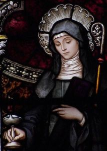
Happy Candlemas!
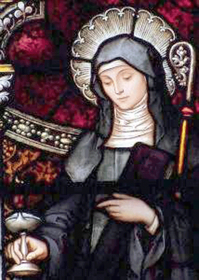
St. Brigid stained glass window
February 2nd – 02/02 – The feast of the flames – the bringing of the light.
This is also the Christian feast of the Presentation of the Lord Jesus in the Temple – the 40th day of the Christmas season.
So many cultures mark this day as a day to think of spring, of the thawing of the earth, the ending of the darkness, the long nights, the coming of the light. We think of St. Brigid of Kildare – Brigid the saint who brought the light of the Word, bread for the poor, peace to the troubled and welcome to the stranger whose feast day – February 1st is part of the “light” celebration.
Tree of the Day series
This is also the day I start a “Tree of the Day series” where I will post images of trees in thin places I have visit. These are special trees – fairy trees, healing trees, trees of mystery, trees associated with stories.
The Tobar Bhride Tree – Kildare
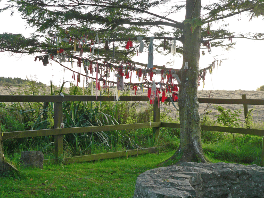
The tree at Tobar Bhride – Kildare
Today I’ll give you the tree at Tobar Bhride (Brigid’s Well) in Kildare. Local people and pilgrims from all over the world visit this well and the tree beside it bringing their prayers of devotion, special intentions and hearts full of thanksgiving for prayers answered.
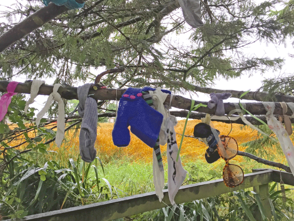
Tokens – “clooties” left on the branches.
As a sign of devotion, the faithful who visit the well sometimes leave a physical reminder of their prayer behind by tying a rag to the tree beside the well. Sometimes they leave something else of meaning behind – a possession of the person for whom they are praying, a photo, a prayer card. These tokens are called “clooties” and the lower branches of the Tobar Bhride tree is covered with them. Some of the clooties pull at the heart of the observer. .. pictures of sick mother, baby shoes, hair ties, little toys.
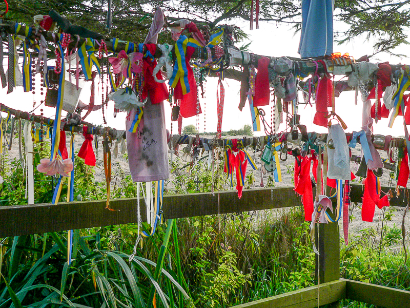
Clooties at Tobar Bhride Kildare
The local people who care for the well and its garden remove the clooties regularly to make way for more. According to the locals, the clooties are buried nearby. One cannot stand by the Tobar Bhride tree and not be moved. It has a quiet but powerful energy.
This tree, the holy well and the Solas Bhride center are a stop on the Discover the North, Castles & Saints and Trail of the Hag tours.
Downpatrick Head Ireland
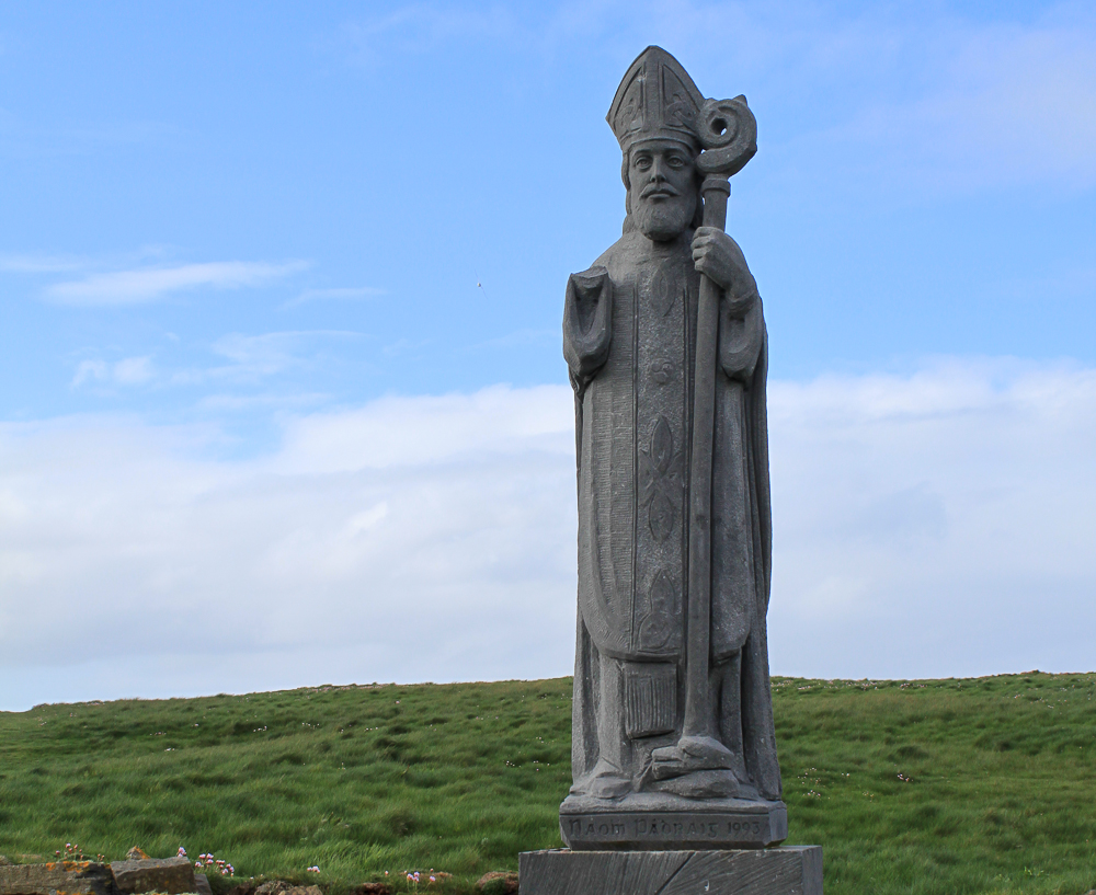
Downpatrick Head in Ireland is on the north coast of County Mayo. It was named for St. Patrick because he is believed to have built a church there, and there still are remains of an old church and a stone marker that supposedly shows where St. Patrick’s original church stood.
Downpatrick Head Ireland
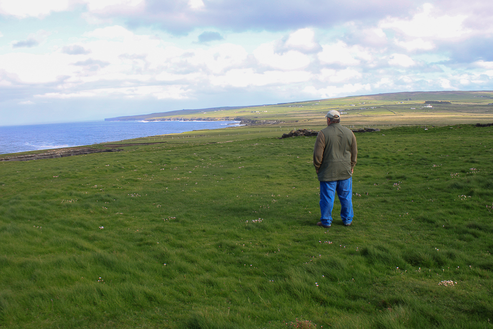
As you approach Downpatrick Head the land opens up in a vast plateau overlooking the wild Atlantic Ocean. You are walking into one of the many “wild places” in Ireland. Even the most boisterous of travel groups will become quiet as they approach the cliffs. The landscape pulls each person into a walking meditation. It almost demands silence.
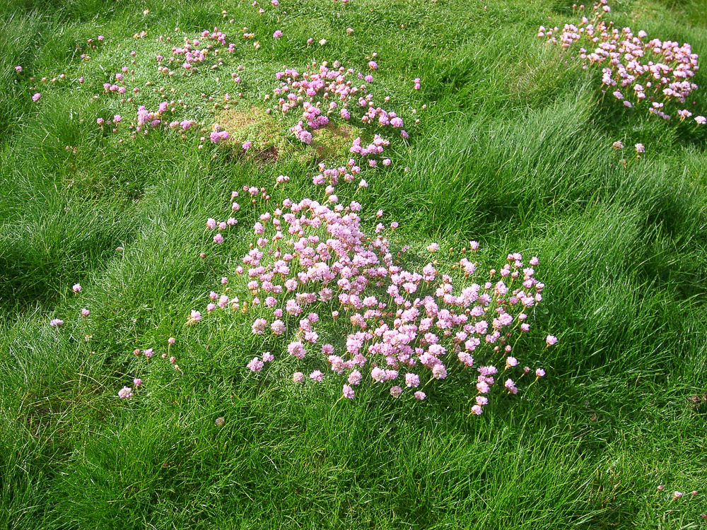
There’s a lovely cliff walk where one can survey the crashing waves of the Atlantic Ocean against the patterned cliffs while hundreds of birds roost in the crevices and swoop and dive all around the cliffs. We were there in May when the “sea pinks” were in bloom and we couldn’t resist taking pictures of them on the cliff tops.
We spent the morning in this magical thin place never noticing the passing of time.
There is also a holy well and a memorial to 25 Irishmen who fled from British Redcoats during a 1795 uprising. They hid in the caves at Downpatrick Head, but couldn’t get back out before the tide came in and flooded the cavern. They all perished.
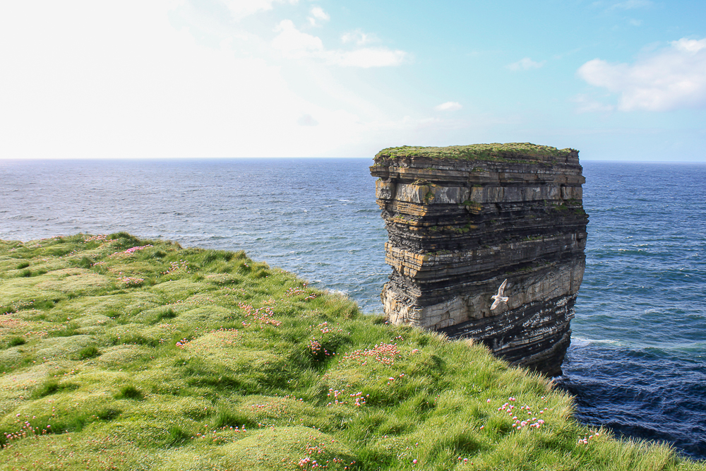
But Downpatrick Head is best known for Dún Briste (Broken Fort) or “the sea stack” which is an outlying stone stack just off the cliff face. The landscape there defines “wild” which is so common to the West of Ireland.
Dún Briste – (broken fort) the sea stack is the landmark most associated with Downpatrick Head in Ireland on the north coast of County Mayo.
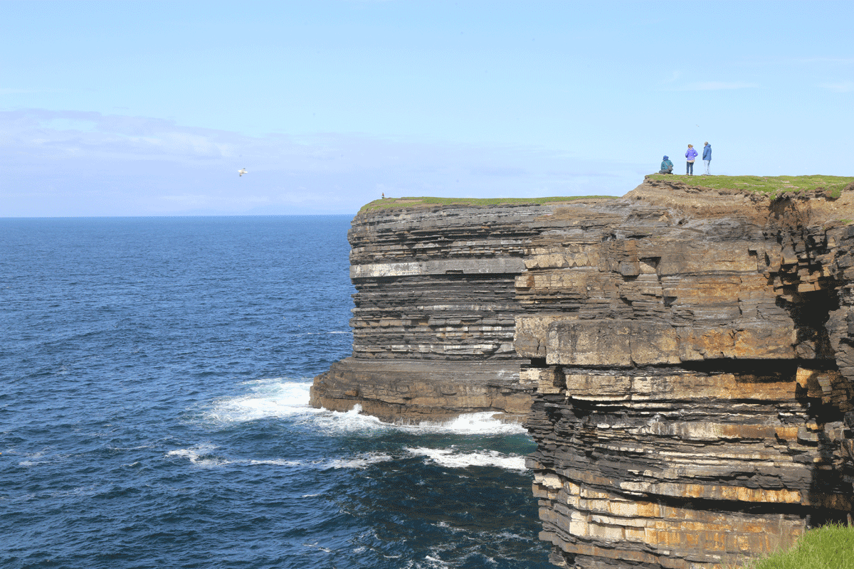
My mind frequently wanders to Ireland. In those rare, still, moments when I can close my eyes and imagine certain places, I almost always go to Ireland. In my imagination, I often place myself at Downpatrick Head. I contemplate the time change – Is it daylight or night time? Where is the moon (or sun)? Is it raining, cold, warm? Are the flowers peeking through the grass? I hear the sound of the waves, the wind, the birds. I feel the damp air. In my mind, I notice all of the details.
Once I settle into that landscape in my mind, the colors take over, then the sounds, then finally — the wind. It seems there’s always wind blowing in Ireland.
I’m reading a fantastic new book by Robert Macfarlane entitled Landmarks, which is about the language that developed around elements of the landscape in the UK and Ireland, and the power of “landscape language.” McFarlane comments in the very first chapter about language shifts that move away from nature and toward technology.
“…Under pressure, Oxford University Press revealed a list of the entries [in the new Oxford Junior Dictionary] it no longer felt to be relevant to modern-day childhood. The deletions included acorn, adder, ash, beech, bluebell, buttercup, catkin, conker, cowslip, cygnet, dandelion, fern, hazel, heather, heron, ivy, kingfisher, lark, mistletoe, nectar, newt, otter, pasture and willow. The words introduced to the new edition included attachment, block-graph, blog, broadband, bullet-point, celebrity, chatroom, committee, cut-and-paste, MP3 player and voice-mail.”
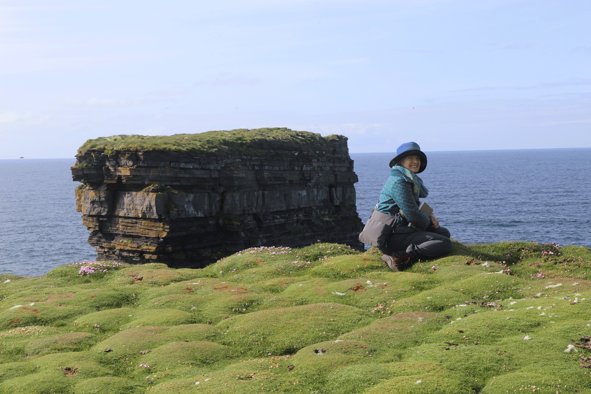
I plead guilty to loving technology, gadgets and the amazing world of telecommunication, but I’ve never embraced it at the expense of stopping and noticing the details in nature.
Sheep roam all over the cliffs at Downpatrick Head … just as they’ve been roaming for centuries. I wonder if they notice the details. Probably not.
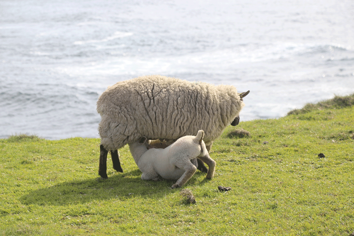
Downpatrick Head Sheep
Here’s to March … and here’s to Spring … and here’s to noticing the details. Those details – the things we only notice when we stand still and look – are the things that connect me to the thin places.
We explore Downpatrick Head is on some of our Thin Places Tours of the Wild Atlantic Way in Ireland.
Photos by Dan and me (Mindie Burgoyne). Special thanks to Joe McGowan and John Willmott who helped identify “sea pinks” and their healing properties.
Best Ireland Guidebooks 2018
Our picks for Best Ireland Guidebooks – 2018
After reviewing 12 general travel guidebooks on Ireland from publishers that included Insights Guides, Moon Guides, Fodor’s, Frommers, Lonely Planet, National Geographic, DK Eyewitness, Michelin and Rick Steves our team has come up with our Top 3 General Guidebooks and our #1 pick for specialty guidebooks for 2018.
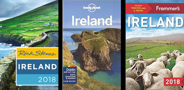
INVEST IN A GOOD GUIDEBOOK – If you think about how much a guidebook costs- $20-$25, that’s the cost of a nice lunch in Ireland. One guidebook can make such a difference in planning your tour and enriching the experience once you’re at a sight. Do yourself a favor and pick up a guidebook or two before you take your trip. We’ve also got links for Books to read before you go to Ireland and Best recommendations for maps and apps.
Top 3 Ireland Guidebooks for 2018
 #1 Rick Steves Ireland 2018
Rick is still our #1 choice and it’s not surprising that he is the #1 guidebook author in the world. His Ireland guide is the #2 best-selling guide on Ireland listed by Amazon (#1 is Lonely Planet’s 2018 guide – our #2). We like Rick’s Ireland guide because it’s the best book about general Ireland stuff with in-depth information on the sites covered. Because Rick Steves is a historian, his commentary on sites that he does cover is so thorough and rich, which makes the visiting experience so much more meaningful. His commentary on Dingle alone is worth the price of the book. He writes as if he is right there with the visitor, leading and guiding the tour. He also offers excellent commentary on the Burren, Galway and a near 40-page chapter on Irish history, language, and slang. All of Rick’s guidebooks are updated every single year.
We’re also excited that our friends – and favorite guides Dingle – Kevin O’Shea and Claire Glavin of Celtic Nature Walking Tours – are featured in Rick’s Dingle section. Kevin is also featured in episode 5 of our Thin Places Travel Podcast
Another perk of this book is that there is a pull-out map in the back. Several guidebooks have maps included but this book has the country map on one side and then a blow-up of 5 cities including Galway, Dublin, Belfast, Derry and Dingle AND the map can be used while still attached to the book, so it can be kept with the guidebook and not lost.
What we don’t like is that if Rick doesn’t like the site, he doesn’t include it. So you may want to look up a particular site and find that it’s not included. But the quality of what he does include is too good to not have the book. So a second guidebook that more like an encyclopedia (covers almost all of the sites) is needed. Which is why we recommend the next two books from Frommers and Lonely Planet.
Rick Steves Ireland 2018 is worth the $23.99 retail price just for the commentary on Dingle, Galway, Belfast and the Burren, which is no wonder it is rated #1 in Amazon’s travel books on Ireland for general interest. It’s also rated (today 3/25/18) as #479 in ALL books listed on Amazon (estimated to be in the millions). If you follow the consumer, this is the book people are buying.
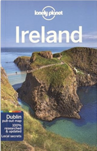 #2 Lonely Planet’s Ireland Guide
Personally, I love Lonely Planet’s publications and love Fionn Davenport (one of their Ireland writers) even more. This guide is included in our Top 3 not because it’s more comprehensive than any other guide, but because of the uncluttered, organized and casual layout Lonely Planet guides offer. Their books are simple and easy to use. This book also features a Top 21 site list and a First Time in Ireland section, maps, suggested itineraries and a section on The Great Outdoors. In years past, Fionn Davenport offered such a unique, casual style – a great storyteller. Though the editors have tightened up on his entertaining, casual commentary, Fionn’s style still shines through. This is still the first guidebook I reach for when looking up sites in Ireland.
 #3 Frommer’s Guide to Ireland 2018
Before this year, we weren’t big fans of Frommer’s. But they’ve outdone themselves with this year’s guide to Ireland. There’s great information about the country, the culture and what to expect as well as a comprehensive listing of most interesting general sites throughout Ireland and Northern Ireland. It’s both comprehensive and diverse with suggested itineraries, maps and a whole section with the “Best of…” lists including Best Castle, Best Natural Wonders, Best Literary sites and Best Museums. This guidebook has serious “personal” appeal. It seems they’ve written it in a “peer perspective” rather than an authoritative perspective. It’s what people want these days .. the personal recommendation of peers. The book also has a compact, tear-out map that has a “town key” so you can easily locate the region of most towns. This would be our #2 recommendation for a comprehensive (all inclusive guide) to Ireland.
#1 Specialty Guidebook – Thin Places Focus
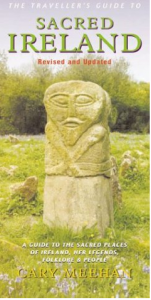 #1 Specialty Guide – Sacred Ireland, by Cary Meehan (out of print – but available on Amazon from Used book dealers – pricey but worth it)
It’s not often that we highly recommend an out of print book, but this year a buyer can at least obtain a used copy from book dealers out there. Even though the copies run $60 and above, this is the best resource for thin places and sacred sites of high energy. Last year there were none to be had. If you can snag a readable copy of this for under $100, do it. It reads like a guidebook with the sites grouped in counties and provinces with a map for each county showing the approximate location of the sacred sites. Even the smallest stone circles, standing stones, and holy wells are mentioned. It was in this book that we found The Giant’s Ring in Belfast (not mentioned in any guidebooks I’ve seen), and it’s an amazing site – a large dolmen set into an earth-work ring that now serves as a public park just outside the city center. The majority of the sacred sites and megaliths in this book are not listed in any guidebooks or on maps. It would take someone years to pull together a list like this. Cary Meehan also writes from a mystical perspective so those seeking the thin places will greatly appreciate her commentary and includes directions (I never depend on these, but they’re a good estimation). If you love thin places, this guidebook is a gold mine. Grab a copy while you can.
Honorable Mention
I reland Travel 101 by Pat Preston
If you ever wanted to pick the brain of an expert on travel to Ireland, you’ll enjoy this book by Pat Preston. For years she worked for the Irish Tourist Board and later had her own tour operation bringing visitors from America to Ireland. Sadly, Pat has passed away, but she left a worthy legacy in this guidebook. She begins the book with all the tips and information people want to know – how electricity works, how to get around, how to plan your trip, what to take… then she highlights various regions offering her personal recommendations for attractions, accommodations and food based on years of experience. I love the sections “If You Have More Time” as options for attractions and sites that are somewhat off the radar. I could do a whole trip with just those recommendations. A very worthy book to have in any travel library.
I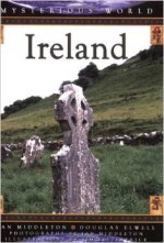 reland from the Mysterious World series, by Ian Middleton
This book is similar to Cary Meehan’s Sacred Ireland in that his lists megaliths and places of mystery. Ian Middleton is a great historian and has laid out the book well. There are also color photographs of the sites which are fabulous. The sites are laid out according to counties so it’s easy to pick add on sites in an area based on what the inventory is. This book offers a good inventory of mystical places. Where Cary Meehan focuses on the mystical nature of a site, Ian Middleton (in this book) focuses on the site’s connection to Ireland’s legendary past.
Biggest Guidebook Dud
 Rick Steves’ Snapshot – Northern Ireland
Though we love Rick Steves, we’re rating his Snapshot of Northern Ireland as a Guidebook DUD not because it’s content isn’t valuable, but because the title is misleading. Rick’s “snapshot” books are merely sections lifted out of the full guidebook so people who only want a small portion can have just that piece of the book. In this case, there just isn’t enough representing this small country of Northern Ireland, and the content pretty much follows how the Irish Tourist Board markets Northern Ireland – Derry and the Antrim Coast with a little of Belfast for good measure.
There are four of six counties left out of this guidebook. It mirrors exactly what the Irish Tourist board (the Republic of Ireland) markets about Northern Ireland. There is so much more. It might have been better to do a “northern snapshot” and included Donegal and Sligo.
To be fair, the content Rick includes on the history of Northern Ireland and the difference in countries, government and currency is valuable. But one could get that same information in most guidebooks – and on Rick’s blog.
Read other posts in this series on books
Books to Read Before You Travel to Ireland
More Books to Read for Travel to Ireland
The Man in the Sand in the Shadow of Mount Brandon
A Man in the Sand Appears on the Beach near Mount Brandon in Dingle
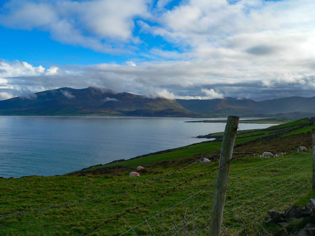
On a dreary February day many years ago, I was traveling alone in Ireland, doing some research for some writing I had to do on thin places in Ireland. Most of this day was spent on St. Brendan the Navigator who was born near Dingle and is a local heroic figure. I visited Ardfert, his first monastery, then Mount Brandon – the holy mountain named for him.
I was in a bad place personally when I wrote this travel journal entry. I’d been working on completing this book for years and I couldn’t move myself forward. No amount of research could push me to completion. Every time I started, I stopped. I had no confidence – filled with self doubt.
This was also a day of miracles – or coincidences. There’s something different about praying in a thin place, though. If you listen hard enough, sometimes you hear an answer or get a sign. This a day for one of those knock-you-in-the-head burning bush signs.
Travel Journal entry – February 20, 2009 – Ireland, Co. Kerry
Mount Brandon – coming from the north road into Dingle after passing the exits for Castlegregory, I came to Fermoyle strand. Mount Brandon dominates the landscape on all the north roads.
Mount Brandon is the second tallest mountain in Ireland and at its base, St. Brendan the Navigator is said to have launched his fleet of curraghs to set sail for the Promised Land as revealed to him in a vision. Prior to the voyage, he spent time on this holy mountain-top in reflection and prayer similar to St. Patrick’s retreat on Croagh Patrick. Also similar to Croagh Patrick, it’s likely that both holy mountains were considered sacred by the local people long before Christianity came to Ireland.
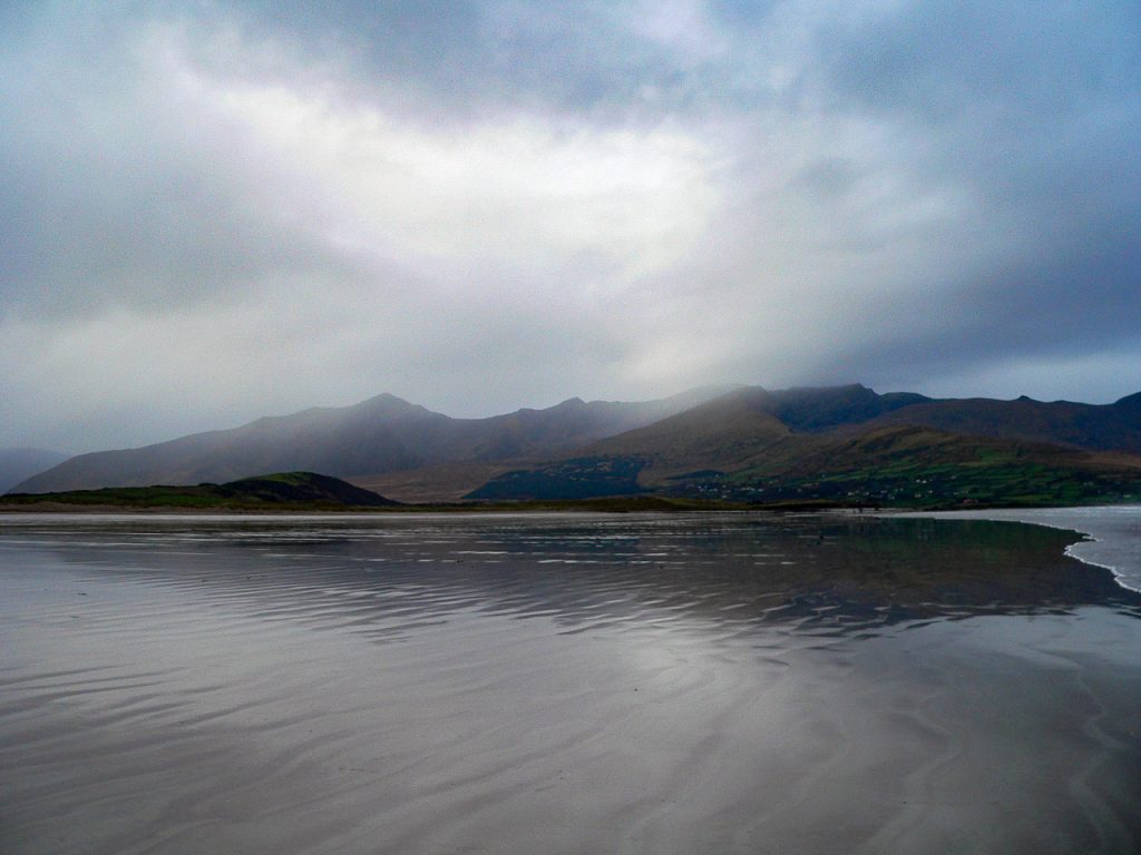
To say the scenery here is breathtaking would understate. It’s magical. The dismal sky and drizzle offered a blue-gray backdrop, but allowed just enough sunlight to illuminate the vivid green fields dotted by sheep at the base of the mountain. Down on the strand the wet sand at the shore is firm – almost like slate. The waves rush in and then Atlantic sucks the surf back out almost a half a mile – leaving various shapes in the flat sand. I was the only one on the strand. The only human image in that landscape.
I pulled into a little car park for people walking out to the beach. It started to rain buckets. So I sat in the car for awhile reading over notes and other authors’ writing about thin places in Ireland. I opened up an article by a well-known author – one whose work had appeared on the New York Times Best Seller list. Though I loved this author’s works of short fiction, I was disappointed in how sappy and trite this piece on thin places was. The writer overtold the meaning. The work left me feeling the writer was trying more to project a sense of spiritual superiority than remark on the mystery of a thin place.
I’m so judgy.
I thought to myself, “how is it that this successful author can get stuff like this published about this places, and I can’t write a word?”
Rain stopped. I continued my indulgence in self-pity as I walked out onto the strand. The tide was out and the sand seemed to stretch on forever. Mount Brandon dominated the landscape. I noticed a pale light hanging it illuminating a very low, wispy cloud just touching the peak. I was then then I stepped into the moment – feeling no passing of time… just being.
With a great sense of inadequacy, I turned to God, or whoever might be listening and said, “I can’t write. No matter how hard I try. I can’t write.”
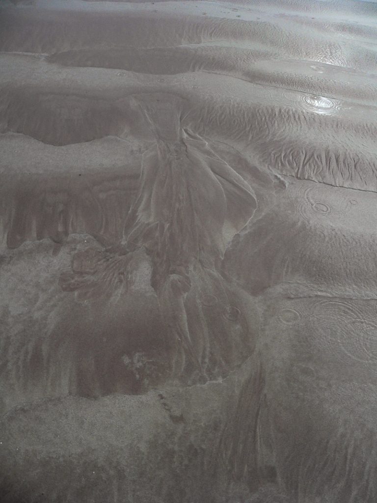
My one-sided conversation was pretty anti-climactic. But then I looked down at the sand. There was an image created by the receding waves. It seemed to have a head, body, legs, and its right hand was extended with what looked like a flower or a box or something. It looked like a faceless man in a cloak. I thought, “Am I really seeing that? I’m just imagining that it looks like a man in the sand. But it didn’t wash away or fade away. So I started snapping pictures.
Even after fifteen minutes the man in the sand was just as clear as he was when I first noticed him. At times like this, I guess we try to find meaning. Was it a sign? Did it mean something? If so, what? I was reluctant to ascribe any meaning to the man, but it sure felt like …. something.
It was surely a synchronistic moment.
Caitlin and John Matthews remind us that we communicate with our five senses in the physical world, but we communicate with our spirit in the spirit world. They also give us insight on how to perceive coincidences moments of synchronicity – the simultaneous occurrence of events that appear significantly related but have no discernible causal connection. Here’s a quote referencing this from their book, Walkers Between the Worlds.
“… synchronicity… is actually an instance of an exact match between the fabric of our world and that of the Otherworld. While we normally dismiss such an occurrence as coincidental, in looking more deeply we can see the exact correspondences between one world and the other.”
After I was done with my man in the sand, I turned to leave. I was headed by car to the foot of Mount Brandon. There’s a road that winds around past Brandon village and ends at a place called Ballydavid north. It’s as far as you can go around Brandon Bay and the road ends at a little car park where one can take off up the mountain on foot. The rain was coming back and about to pour. The sky was black. As I turned to leave the beach I notice a bright ribbon of a rainbow in the eastern sky. Wow.
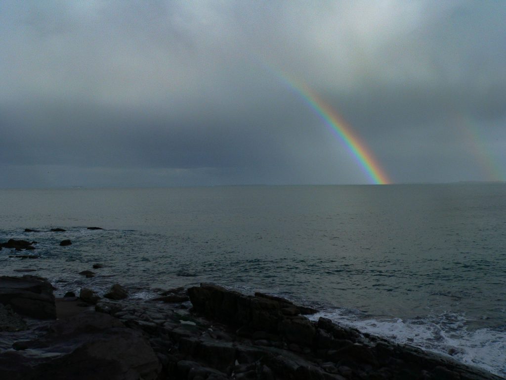
Another sign? Maybe. Maybe another coincidence.
I got to the car and headed out. For 20 minutes I drove and for 20 minutes that rainbow followed me. It was still there when I got to the foot of Mount Brandon. And I stayed there another twenty minutes as the rain fell and the sky cleared … watching it fade away. What a day.
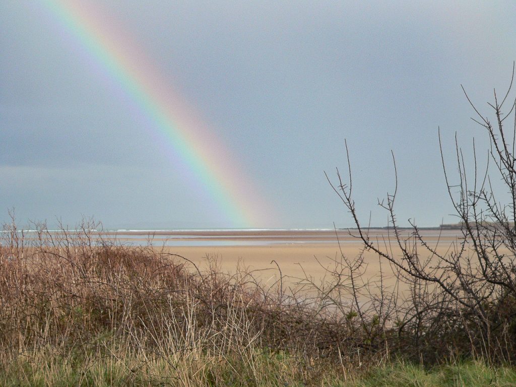
The eternal world or spirit world or Otherworld is one side of reality while our physical world is the other. But together they show us one world, one reality. A thin place brings us face to face with these two sides of one reality, and our prayers – our conversations with the Creator are whole and enjoy a sense of completeness.
Fermoyle Strand and Mount Brandon are thin places. At the time I was experiencing the above-mentioned synchronicity in Dingle I didn’t understand what any of it meant. Thus the importance of journaling and taking photo images. As we grow in spirit, so does our understanding.
And when I got home … I couldn’t stop writing. I’m still writing.
Dunadd Fort – Kilmartin Glen
Dunadd – Ancient Royal Center – Kilmartin Glen
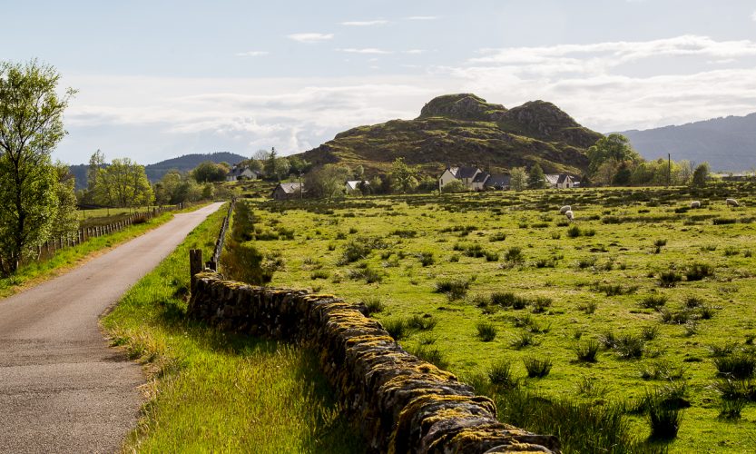
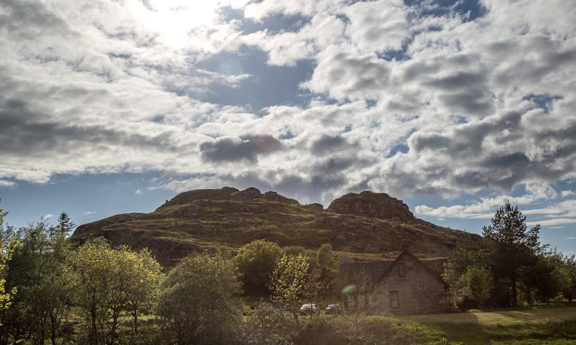
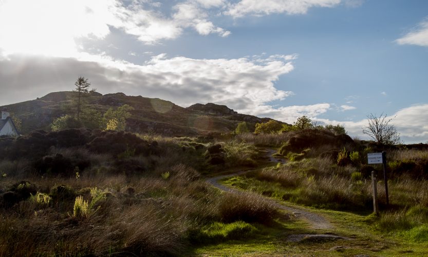
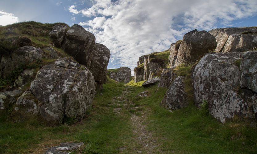
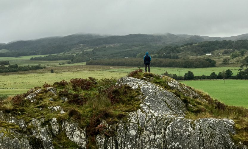
The remains of Dunadd Fort in the Kilmartin Glen in Argyle, Scotland rise out of the Glen like an old boulder dropped from the heavens. Everything around it is flat – and then, there it is. A lumpy hill that is perhaps 4 stories high sitting in a landscape that houses over 300 ancient monuments – the largest collection in all of Scotland. This was the 6th century political and ritual site where the first Scottish Kings were crowned, and where they ruled from. Here is a one minute video showing the path from the valley floor to the Citadel.
This site not only has an ethereal feel at the top, it vibrates with ancient, almost celestial energy. The spiritual energy is almost overwhelming when one climbs to the top alone. The entire ascent to the top becomes a walking meditation.
The Kilmartin Glen
The Kilmartin Glen has over 300 ancient monuments in a few square miles. Dunadd is one of them and situated at the end (or beginning) of a linear trail that holds most of the megalithic structures.
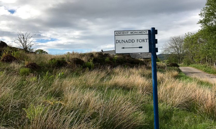
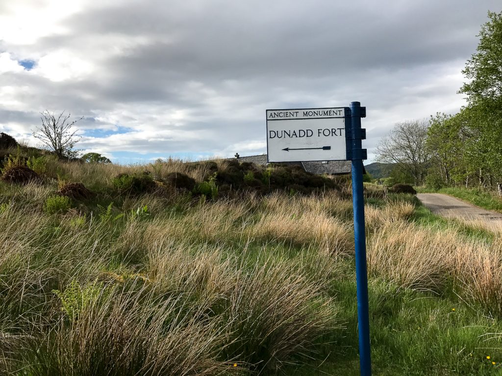
When I set out to explore the ancient monuments, I was looking for the stone circles, the standing stones, the tombs, the rock carvings. As I up the A816 from Lochgilphead I knew that I was coming into the Glen and was watching for directional signs to the monuments. I happened to look left and saw this lone, rocky hill and thought how strange it was to be situated there in all of that flatness. Then I saw the signage for Dunadd Fort and realized that this rock in the middle of the Glen was, in fact, one of the monuments.
Ancient Seat of the Early Scottish Kings
Though fortifications of this fort go back 2400 years, the hill’s use as a royal site and political center run from about 600 to 750 AD. This was the royal seat of the Dál Riata tribe. They had a common language and culture with the Ulster tribes in the north of Ireland. The descendants of this tribe were the Scotti (the name Scotland derives from this group).
Though it looks like a lumpy rock, it was once fortified with a protective rampart there were also dwellings, a well that served the entire community on the rock and even an industrial center where jewelry was made for royalty and the social elite. Up at the top of the rock was the site where royal rituals took place.
The Inauguration Stone
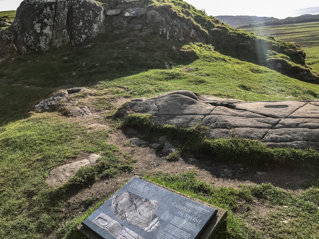
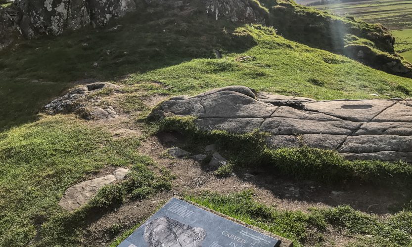
The most impressive artifact remaining on the site is the Inauguration Stone. At the top of the hill (at the lower elevation) is a flat stone with a footprint carved out. There is also ogham writing on the stone and other writings believed to refer to sacred rituals. The candidate for king would be brought here in a procession and a ritual would be carried out on this spot where the pending king would place his foot in the footprint on the sacred stone signifying that he was married to the land – and hopefully this marriage between king and land would yield fruitful harvests and a blessing on the people.
The actual stone used in the 7th and 8th century lies beneath the one we see currently at the crest of Dunadd. A concrete replica was placed overtop the original in order to protect the original stone. But it gives the visitor a glimpse of what the actual stone looked like in this place.
I snapped a photo (pictured above) of the stone and noticed later that a beam of sunlight was shining directly on the footprint. It was a magical time up there all by myself.
The Citadel at Dunadd.
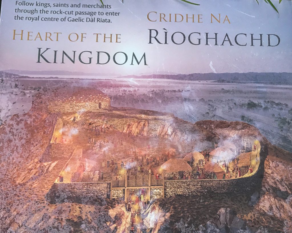
Image of what the Citadel may have looked like.
Directly above the Inauguration Stone at the highest point on the hill, is a slight rise to a flat terrace level. Researchers believe this was a citadel – an enclosed building where political discussions were held. It was the governmental meeting place situated perfectly at the top of the hill.
The panoramic views from this plateau are stunning and take in all of the Kilmartin Glen which sits on the banks of the snaking River Add. The island of Jura can be seen in the distance. Iona is only 35 miles away.
St. Columba and Iona
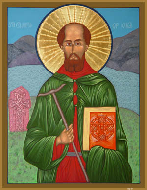 The Irish have a wonderful tale about the self-imposed exile of St. Columba. After his prideful actions caused a war between Irish tribes that cost lives and treasure and brought sorrow to the people, Columba got in a boat with twelve followers and set out from Derry heading for a new home. He stopped at the first island he came to where he could no longer see his beloved Ireland and that was Iona where he founded (started) Christianity in Scotland.
Scottish historians believe that Columba negotiated with King Comgall in about 563AD to use Iona for the founding of a monastic community. That negotiation would have most likely occurred in this Citadelidel on the top of Dunadd Fort. Remember these Argyle tribes were related to the northern Irish. They spoke the same language and shared an ancestral history. It’s likely that the King would benefit by having Columba found a monastery because monastic communities brought education to the people and Columba had a successful track record a mile long.
So while the story of the meeting between Columba and King Comgall isn’t as romantic as the Irish story of sailing into the west and arbitrarily landing on Iona, it’s quite a rush to stand on the Citadel at Dunadd Fort and imagine that you’re standing in the same spot where Iona and Christianity were likely negotiated by King and Monk.
Powerful Energy Still Lingers
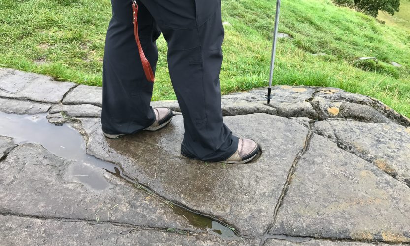
Setting all the history and stories aside, Dunadd Fort has an energy that is nearly palpable at the top. Climbing it requires great care both ascending and descending, but it can be done carefully. Great care should be taken if the stones are wet because they are slippery. The views and the atmosphere for meditation are worth the effort.
Inchmahome Forest Walk – Stirlingshire, Scotland
Inchmahome Forest Walk Ancient Trees
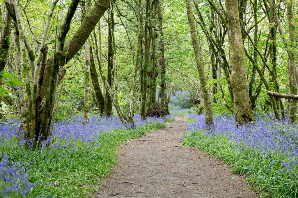
Inchmahome is a tiny island in the Lake of Menteith, which lies about halfway between Aberfoyle and Callander at the edge of the Loch Lomond & Trossachs National Park. The island is covered with trees and has a remarkable Forest Walk, but it also houses the ruins of an old 13th-century priory that sits in the center of the island.
Inchmahome, though small and only one of the scores of monastic communities that were scattered around Scotland, had some famous visitors. Robert the Bruce visited in the 1500s as did King Robert II. The most romantic visitor tales are center around Mary Queen of Scots, her mother, Marie deGuise and the “Four Marys” who served as Princess Mary’s ladies in waiting. Marie deGuise sought refuge at the Inchmahome Priory for five-year-old Mary Queen of Scots during military conflicts between Scotland and England that put the little princess’s life in danger. Old legends say that child Princess planted the Spanish Chestnuts and that those majestic trees can conjure the spirit of Mary Queen of Scots onto the island from time to time.
Two Minute Video of the Inchmahome Forest Walk – Trees Have Faces
There are many species of trees – perhaps the most famous are the Spanish Chestnuts, which are said to date back to the 1500s. They’re not easy to miss. They are the royalty of this forest and exude an energy that one can almost hear in the wind. If you relax your eyes and gently stare at these chestnuts, their aura is soon visible – gold, radiant.
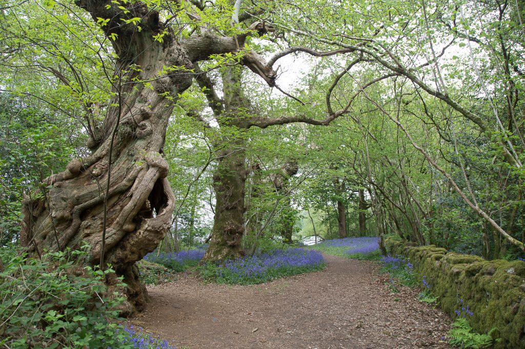
Forest Walks – Do the Trees Have Faces?
It’s interesting how fairy tales and folklore set the scariest stories in forests. Why are forests so scary? Perhaps it isn’t the forest that is scary. Perhaps it’s that our own minds that become keenly sensitive to otherworldly things when we are completely surrounded – above, below and besides – by nature, uninterrupted by development or the outside world. Something happens to our senses when we are immersed into that fury of elemental life. In fairy tales, the trees sometimes come alive – have faces – arms – and attack the forest walker… or worse.
I’ve noticed that when I walk in some forests quietly alone, after about 20 minutes I notice the details I couldn’t see before. The shapes of the branches, the colors, the textures…. and in some forests, the trees come alive with faces and human characteristics. Such was my experience at Inchmahome.
The forest became Otherworldly. It’s places like these where we can absorb the energy, the healing, the insight that comes with walking in thin places.
This little forest is worth visiting even if it’s the only thing you see in Scotland.
The Lake Hotel on Lake of Menteith
Our friends own the Lake Hotel on the shores of the Lake of Menteith and the boats that go out to Inchmahome are a short walk from that Hotel. This is where we stay during this leg of our Scotland tours because guests can savor that sense of “a thin place” for a while.
Dunadd Fort in the Kilmartin Glen, Argyle Scotland
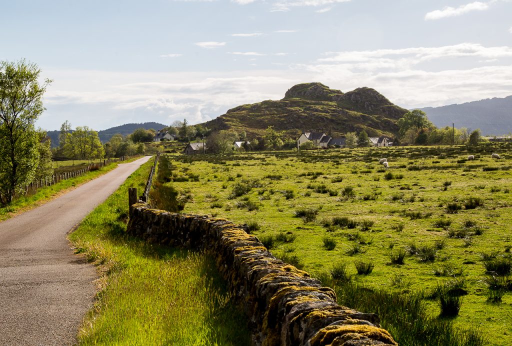
Dunadd – Ancient Royal Center – Kilmartin Glen
The remains of Dunadd Fort in the Kilmartin Glen in Argyle, Scotland rise out of the Glen like an old boulder dropped from the heavens. Everything around it is flat – and then, there it is. A lumpy hill that is perhaps 4 stories high sitting in a landscape that houses over 300 ancient monuments – the largest collection in all of Scotland. This was the 6th century political and ritual site where the first Scottish Kings were crowned, and where they ruled from. Here is a one minute video showing the path from the valley floor to the Citadel.
Dunadd Fort and the Kilmartin Glen are sites on The Monks Trail Scotland tour.
This site not only has an ethereal feel at the top, it vibrates with ancient, almost celestial energy. The spiritual energy is almost overwhelming when one climbs to the top alone. The entire ascent to the top becomes a walking meditation.
The Kilmartin Glen
The Kilmartin Glen has over 300 ancient monuments in a few square miles. Dunadd is one of them and situated at the end (or beginning) of a linear trail that holds most of the megalithic structures.
When I set out to explore the ancient monuments, I was looking for the stone circles, the standing stones, the tombs, the rock carvings. As I up the A816 from Lochgilphead I knew that I was coming into the Glen and was watching for directional signs to the monuments. I happened to look left and saw this lone, rocky hill and thought how strange it was to be situated there in all of that flatness. Then I saw the signage for Dunadd Fort and realized that this rock in the middle of the Glen was, in fact, one of the monuments.
Ancient Seat of the Early Scottish Kings
 hough fortifications of this fort go back 2400 years, the hill’s use as a royal site and political center run from about 600 to 750 AD. This was the royal seat of the Dál Riata tribe. They had a common language and culture with the Ulster tribes in the north of Ireland. The descendants of this tribe were the Scotti (the name Scotland derives from this group).
Though it looks like a lumpy rock, it was once fortified with a protective rampart there were also dwellings, a well that served the entire community on the rock and even an industrial center where jewelry was made for royalty and the social elite. Up at the top of the rock was the site where royal rituals took place.
The Inauguration Stone

The most impressive artifact remaining on the site is the Inauguration Stone. At the top of the hill (at the lower elevation) is a flat stone with a footprint carved out. There is also ogham writing on the stone and other writings believed to refer to sacred rituals. The candidate for king would be brought here in a procession and a ritual would be carried out on this spot where the pending king would place his foot in the footprint on the sacred stone signifying that he was married to the land – and hopefully this marriage between king and land would yield fruitful harvests and a blessing on the people.
The actual stone used in the 7th and 8th century lies beneath the one we see currently at the crest of Dunadd. A concrete replica was placed overtop the original in order to protect the original stone. But it gives the visitor a glimpse of what the actual stone looked like in this place.
I snapped a photo (pictured above) of the stone and noticed later that a beam of sunlight was shining directly on the footprint. It was a magical time up there all by myself.
The Citadel at Dunadd.

Taken from Interpretive Signage at Dunadd Fort courtesy of Historic Scotland
Directly above the Inauguration Stone at the highest point on the hill, is a slight rise to a flat terrace level. Researchers believe this was a citadel – an enclosed building where political discussions were held. It was the governmental meeting place situated perfectly at the top of the hill.
The panoramic views from this plateau are stunning and take in all of the Kilmartin Glen which sits on the banks of the snaking River Add. The island of Jura can be seen in the distance. Iona is only 35 miles away.
St. Columba and Iona
 The Irish have a wonderful tale about the self-imposed exile of St. Columba. After his prideful actions caused a war between Irish tribes that cost lives and treasure and brought sorrow to the people, Columba got in a boat with twelve followers and set out from Derry heading for a new home. He stopped at the first island he came to where he could no longer see his beloved Ireland and that was Iona where he founded (started) Christianity in Scotland.
Scottish historians believe that Columba negotiated with King Comgall in about 563AD to use Iona for the founding of a monastic community. That negotiation would have most likely occurred in this Citadelidel on the top of Dunadd Fort. Remember these Argyle tribes were related to the northern Irish. They spoke the same language and shared an ancestral history. It’s likely that the King would benefit by having Columba found a monastery because monastic communities brought education to the people and Columba had a successful track record a mile long.
So while the story of the meeting between Columba and King Comgall isn’t as romantic as the Irish story of sailing into the west and arbitrarily landing on Iona, it’s quite a rush to stand on the Citadel at Dunadd Fort and imagine that you’re standing in the same spot where Iona and Christianity were likely negotiated by King and Monk.
Powerful Energy Still Lingers
Setting all the history and stories aside, Dunadd Fort has an energy that is nearly palpable at the top. Climbing it requires great care both ascending and descending, but it can be done carefully. Great care should be taken if the stones are wet because they are slippery. The views and the atmosphere for meditation are worth the effort.
Faces in the Rock – Glenariff Woodland
 Forests and Woodlands tend to scare us. If they don’t evoke fear they at least elevate our senses. The edge is defined. We feel it as soon as we cross from the open world into a woodland. The energy shifts – changes.
My friend, Wendy Mews leads tours to sacred sites in Brittany. Wendy led me through a forest near her home in Huelgoat and talked about “walking meditation.” She said that she will tell her tour guests to walk in the forest as a group – but in total silence. And she instructs her guests to notice details in that silence, to be mindful of what the forest tells them. “What do you hear in your heart? What do you feel? What does the forest tell you?”
It’s funny how a chance conversation can you change one’s life. Since that conversation with Wendy, I’ve been unable to walk into a forest and not be mindful of what its telling me. I try to walk in silence…to notice details… to see what reveals itself.
The Glenariff Woodland
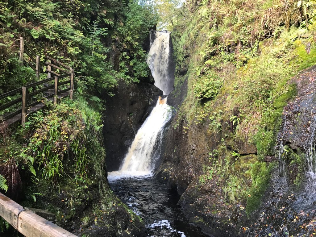
In the Glenariff Woodland, there is a defined path that easy to walk. It winds into a gorge with rushing water, waterfalls, mist coming off of the rocks, all the mystical plants – ferns, ivy, holly, and a rare woodland plant known as “St. Patrick’s Cabbage.” The path is lined with oak, ash, willow and hazel trees.
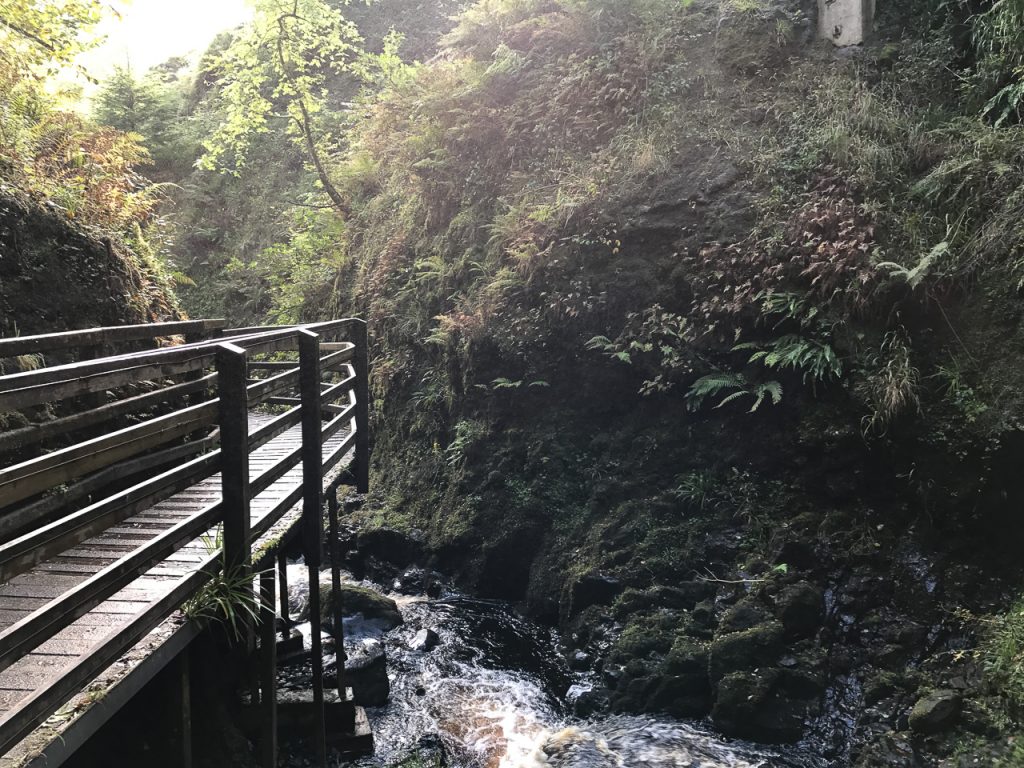
This forest was a stop on our Discover the North tour. I led my tour guests into this woodland and let them roam.
I stayed behind and then walked in silence…waiting for the woodland to speak to me.
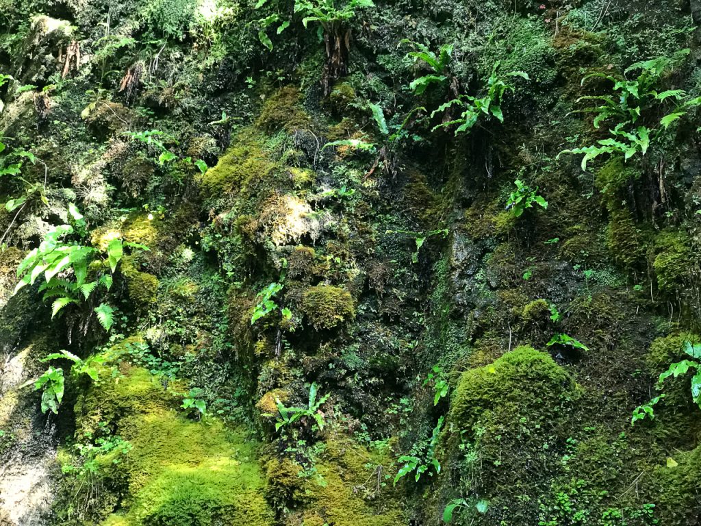
Faces in the Rock
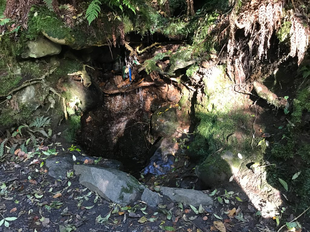
There was a holy well along the path that had a few clooties tied to branches in the rock face.
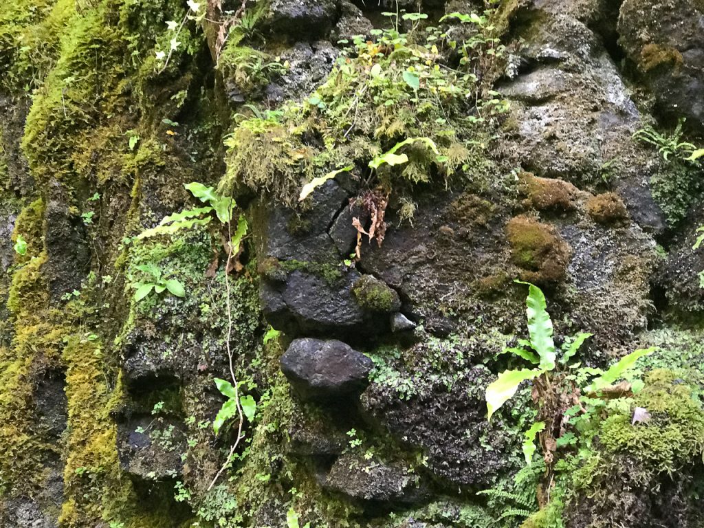
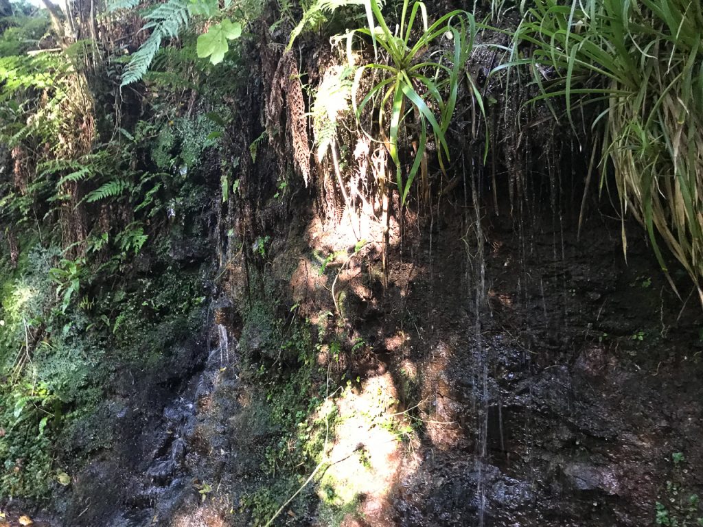
 As my guests passed by me, they seemed to walk in silence too, though I hadn’t instructed them or encouraged them to do so. They were all so happy in that woodland. I stopped for a moment where the gorge wall rose steeply above the path – almost perpendicular to where we stood. In that time of reflection waiting for the woodland to “speak to me” I started to see faces – hidden in the rocks, moss, ferns and the watery surface of the gorge – – many faces. Faces made from the natural elements.
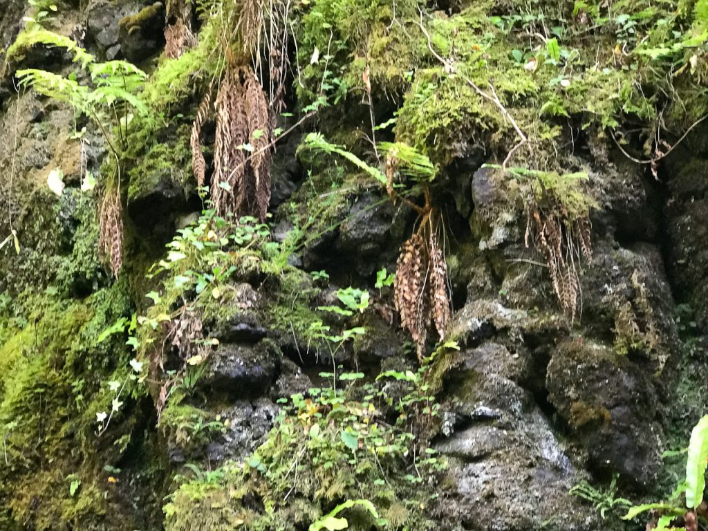 I pointed this out to my guests when they passed, and they saw them, but weren’t moved by them – not like I was anyway.
The Glenariff Waterfall Nature Reserve
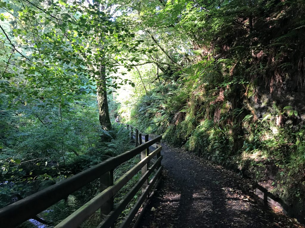
Glenariff Waterfall Nature Reserve is in the Glens of Antrim. Glenariff the largest of the nine Glens and many think it’s the most scenic. This entrance to this woodland path is located behind Large Lodge, a seasonal restaurant that has a wonderful ambiance and good food. You can park in the Lodge’s lot, have a bite to eat and then amble along the gorge path. The complete walk is about 1.5 miles and has steps and gets steep at times. But those who can’t negotiate the stairs can still enjoy the beginning of the trail.
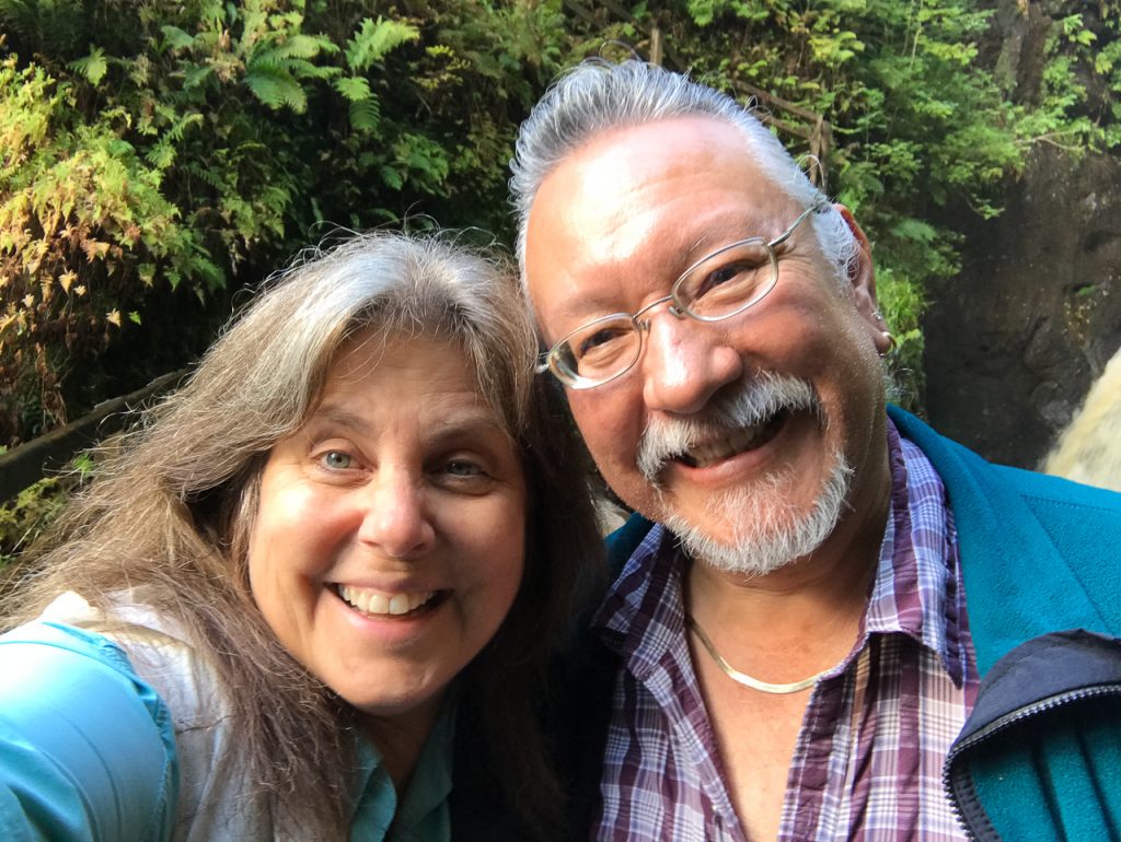
The waterfalls and woodland are magical. Maybe you’ll see the faces.
The Glenariff Woodland Walk is on the Discover the North tour of Ireland.
A Bridge to the Otherworld – A Rainbow at Beltany
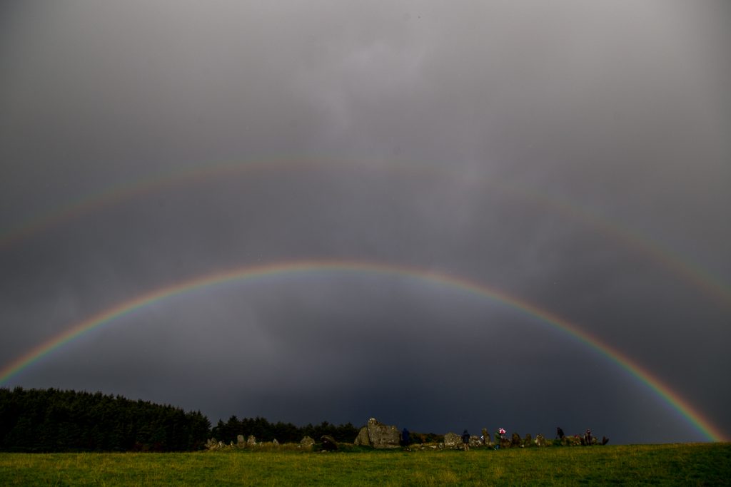
It appeared as if it was a bridge to the Otherworld… the rainbow we saw at Beltany stone circle on the eve of the Autumnal Equinox. The vision was certainly otherworldly. After seeing such a display there’s always the urge to make some kind of sense of it. To find some meaning.
Every culture has its own symbolic meaning for the rainbow. Most traditions focus on connection, a bridge to the otherworld, a promise from God, a sign of hope, a call to follow one’s heart. On the eve of the Autumn Equinox, I led a group up the path to Beltany stone circle in County Donegal. It was wet, rainy and overcast. The field approaching the circle was littered with cow dung. Several of my group turned back finding nothing particularly mystical about Beltany. But for those of us who stayed, the landscape shifted dramatically within fifteen short minutes.
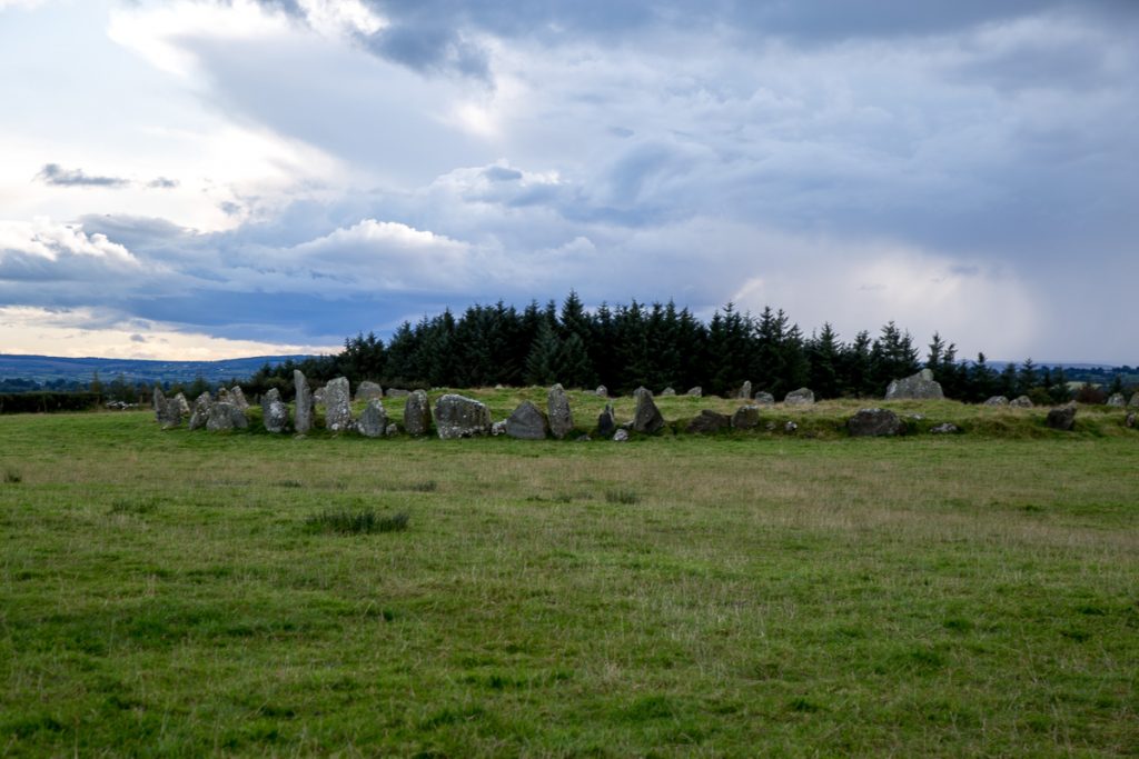
Beltany stone circle dates back to 1400 – 800 BC. With its 64 stones averaging 6 feet in height, it is larger than most found in Ireland. The circle measures about 145 feet in diameter. The site was significantly disrupted during an early twentieth-century excavation leaving the center of the circle lumpy with stones now covered by grass.
Most believe that there were at least 80 stones in the original circle. A wide triangular stone with cup markings immediately draws the eye and stands out from the others (shown to the right in the image above). It faces ENE and stands directly across the circle from the tallest stone (about six feet high) which points WSW. When the two stones align they point to the summit of a hill across the valley. On May 1st – the feast of Bealtaine – that the sun rises over that hill and aligns with these two stones. The circle’s name, “Beltany” likely refers to this celestial event and the feast of Bealtaine.
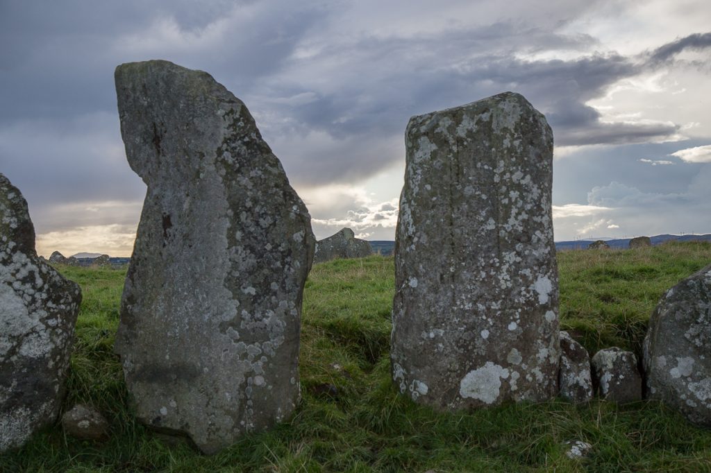
The Rainbow at Beltany
As we walked up the secluded path to the open field where the circle stands, my tour group was tired, the skies were gray and there was a slight drizzle. I was disappointed because I wanted my guest to love the circle as much as I did, but I could see that some of them remained on the bus and others exited quickly due to the difficulty of walking through a wet cattle field. I had only a portion of the tour group at the circle. Then it started to pour.
My heart sank. I want so much for this to be a perfect experience. But sometimes the weather won’t cooperate.
But sometimes the weather and the landscape surprises us.
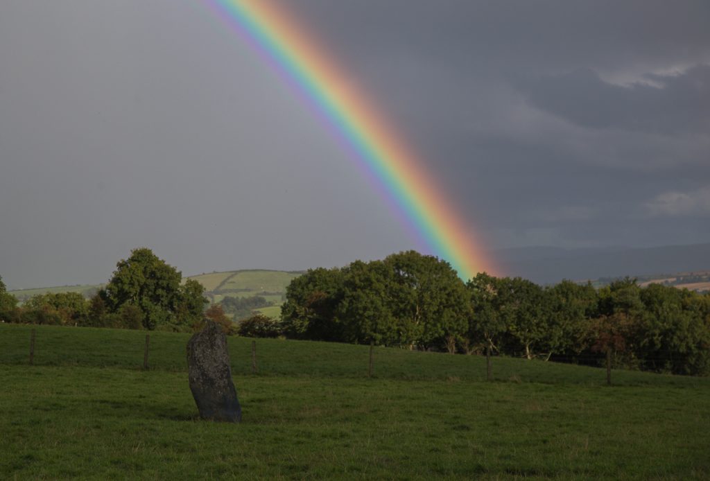
As the rain softened, I happened to turn around toward the entrance to the field. I saw a pretty vibrant rainbow that was halfway across the sky. I called out to my tour guests to look at it. No one said a word – we just stared.
Then together we watched this rainbow spread perfectly across the sky over the circle. Then a second one appeared over the first. The clarity of the colors was stunning. Then we noticed that there was a darkness or shadow between the two bows. The space between was charcoal colored – different from the sky making the set of rainbows appear to be one thing.
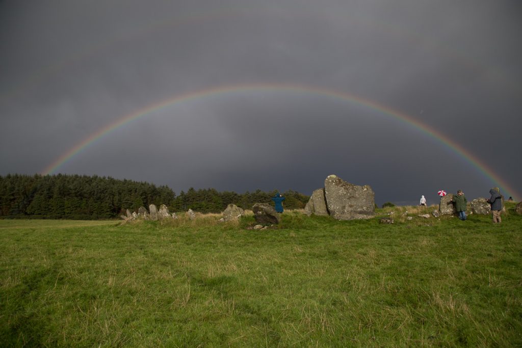
Even the sheep in the field were looking up at the rainbow.
One of my guests said, “In my seventy-one years of life, I have never seen anything like this.” It almost seemed as you could walk out to the end and touch the rainbow. Then the same guest pointed out that the colors were reversed on the second rainbow. Each rainbow was a reflection of the other with the colors going in opposite order – a perfect reflection – a mirror image. Traces of a third rainbow could be seen at the edges of the second.
The Symbolic Meanings of a Rainbow
A rainbow is a fusion of light that projects a harmonious – almost supernatural specter of all the world’s colors visible to the human eye. Every culture in every time has been moved by the sight of the rainbow. It nudges us to find some meaning in the presentation of something so spectacular. The Judeo Christian tradition is rooted in the book of Genesis.
It shall be, when I bring a cloud over the earth, that the rainbow shall be seen in the cloud; and I will remember My covenant which is between Me and you and every living creature of all flesh; the waters shall never again become a flood to destroy all flesh.Genesis 9:14-15
The first nations in North America, as well as many Asian cultures, saw the rainbow as a bridge or passage between the earthly and spirit worlds.
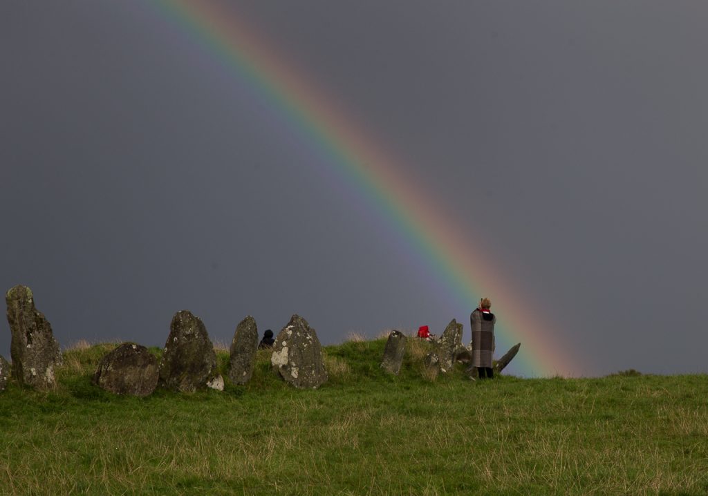
The ancient Irish or pre-Christian Irish saw the rainbow as a sign of blessing – the arc symbolized femininity – the rounded belly about to give birth, which is so appropriate for Beltany because the circle was likely created to celebrate that feast which encourages and blesses fertility and birth. The rainbow was often interpreted as a promise of good luck, abundance a sign to follow the heart’s desire or follow your dreams.
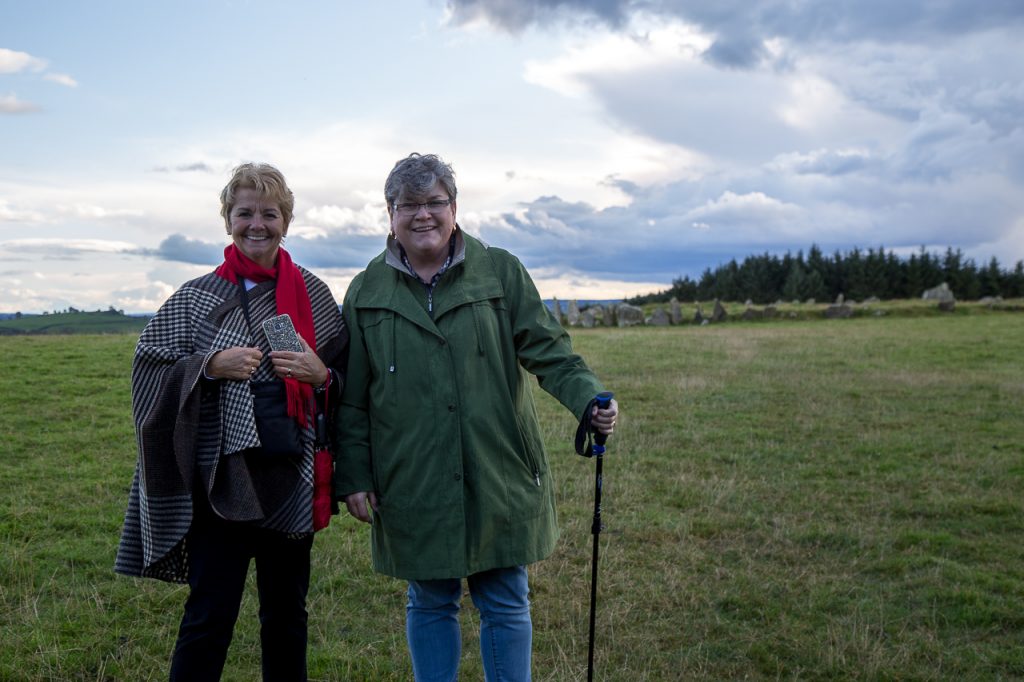
Guests on Discover the North tour after the rainbow
We’ve all heard of the old Irish saying to follow the rainbow and find the “pot of gold.” The rainbow was often interpreted as a promise of good luck, abundance a sign to follow the heart’s desire or follow your dreams. And standing at the edge of that circle and seeing the pulsing vibration of light against the field, one can perceive an actual “physical” end of the rainbow. Almost as if the pot of gold could be within reach. The light is mesmerizing.
I love the kitschy words of the song from the musical Finian’s Rainbow
Look, look, look to the rainbow
Follow it over the hill and stream.
Look, look, look to the rainbow
Follow the fella’ who follows a dream
In the end, it doesn’t really matter what the rainbow means or doesn’t mean. Just standing in the presence of such a sight was gift enough for me. And it will always be a part of my memories of Beltany.
St. Gobnait – Patron of Beekeepers – County Cork
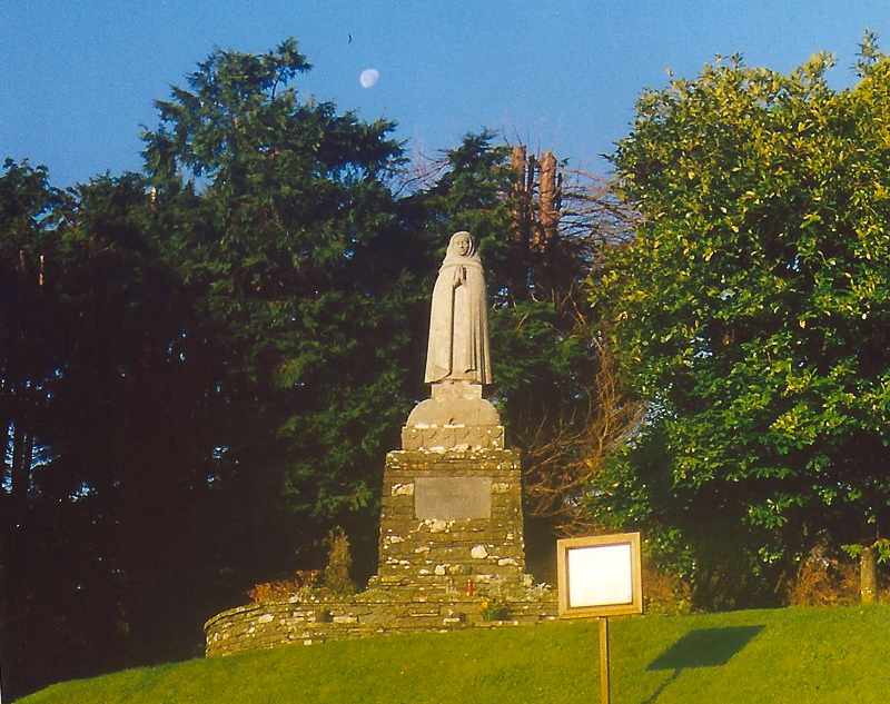
The Beekeepers’ Saint – Gobnait of Beekeepers
St. Gobnait (Irish for Deborah or Abigail), the patroness of Beekeepers and healers, is celebrated in Ballyvourney, a small town in West Cork. Her Feast Day is February 11th.

St. Gobnait, patron of beekeepers – Image by Patricia Banker
In the early 6th century when Gobnait fled her home in County Clare, she went to Inis Oírr (the smallest of the Aran Islands). We don’t know why she fled, only that she believed she would find refuge in the Aran Islands. Legend states that an angel appeared to her there and told her that her place was not on Inis Oírr, and instructed Gobnait to go on a journey – to seek her true place of resurrection. “Go until you find nine white deer grazing, ” the angel told her. “It is there that you will find your place of resurrection.” So Gobnait wandered about the southern coastal counties of Ireland – Waterford, Cor, and Kerry – searching.
She saw three white deer in Clondrohid and followed them to Ballymakeera where she saw six more. But it wasn’t until she came to Ballyvourney to a small rise overlooking the River Sullane that she saw the nine white deer all together – grazing … just as the angel from Inis Oírr had prophesied. She crossed the river and settled there. She founded a religious community for women, performed memorable – some say miraculous – works, and it was there she died and was buried.
St. Gobnait’s journey from Inis Oirr to the towns in West Cork including sites in Ballyvourney – her monastic settlement, tomb, and holy well are part of the Places of Resurrection tour.
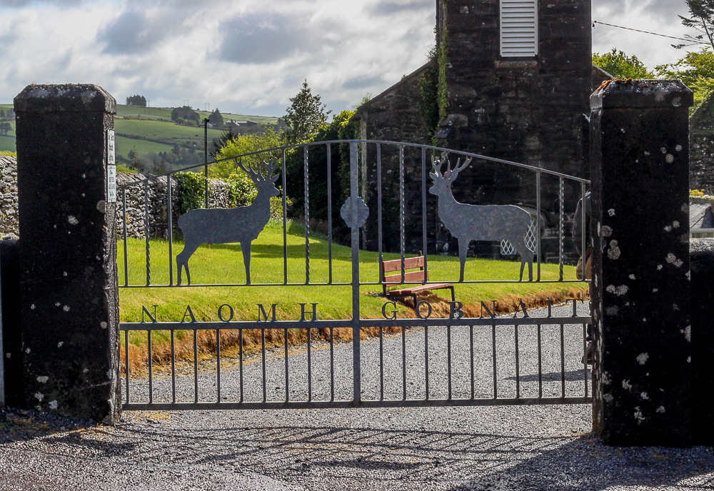
On February 11th (St. Gobnait’s feast day) she is tenderly remembered in her native region. But she has also been proclaimed by the Irish bishops to be a national saint. There are shrines and places of devotion to St. Gobnait in all the places she is believed to have stopped on her journey – including Inis Oírr. But Ballyvourney – is that special place for Gobnait… the place she felt most at home, the place where she carried out most of her ministry. And Ballyvourney is the place that draws the greatest number of pilgrims devoted to this saint.
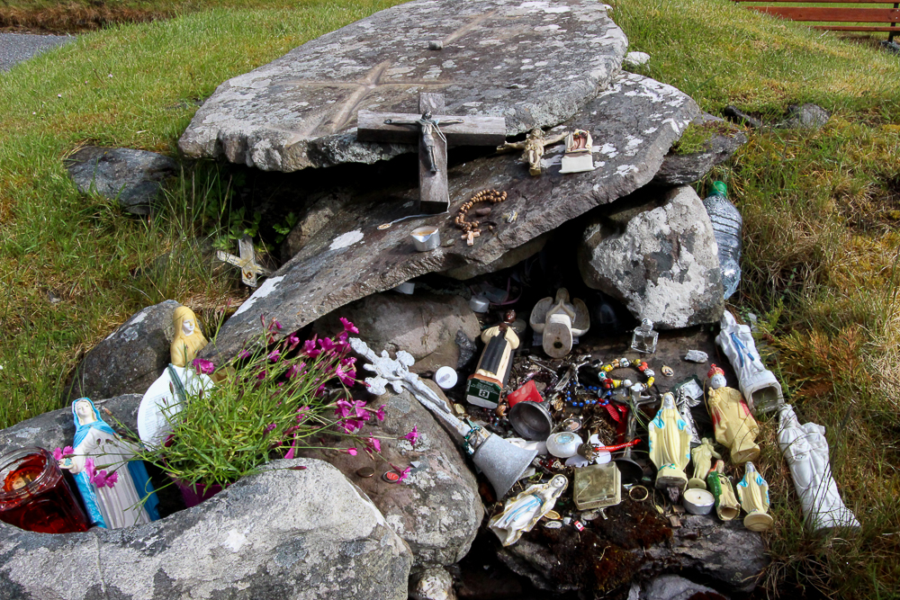
St. Gobnait’s Tomb Ballyvourney – County Cork
Today there is an active church on the former monastic site. St. Gobnait’s grave and marked spots around the churchyard are places where pilgrims pause for devotion and reflection. It is here that they can do the “rounds” or turas, always moving in a clockwise direction – a tradition that has pagan roots. One of the strongest mystical draws on this site is St. Gobnait’s Holy Well, with its arched entryway that takes the pilgrim into a deeply shaded path. Just next to the well is a sturdy tree, and hanging from it are hundreds of tokens or “clooties ” that have been placed there by pilgrims hoping to leave behind a part of themselves or loved on in need of healing. There are taps and cups available for drinking from the well or for pouring into personal vessels to take holy well water home.
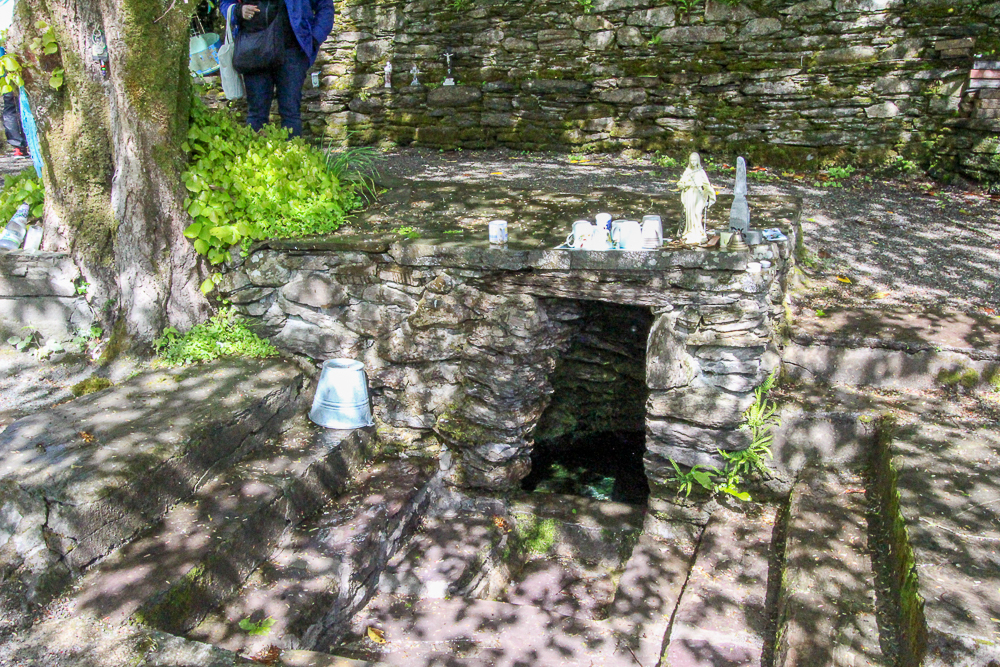
St. Gobnait’s Holy Well – Ballyvourney, Co. Cork
St. Gobnait was best known for her care of the sick. There is a legend that tells of her staving off the plague from Ballyvourney by drawing a line in sand with a stick and declaring the village “consecrated ground.” Inside the church today, there is a medieval (possibly 13th century) figure of St. Gobnait which is kept in a drawer. Every year on her feast day, the parish priest brings out the figure to celebrate a devotional tradition. He holds up the ancient figure and the faithful each step forward with a piece of ribbon. They hold the ribbon up and measure it against the length and around the circumference of the figure, then take it home as a blessed relic used for healing or further devotion.
A tall statue of St. Gobnait that was erected in the 1950s stands near the monastic site. She appears with a nun’s habit standing on a beehive surrounded by bees. Gobnait is the patron saint of beekeepers, and there are several legends recalling Gobnait forcing invaders out of Ballyvourney by setting swarms of bees upon them. It’s probable that Gobnait had a close relationship with bees and used honey in healing efforts.
PLACE OF RESURRECTION
Dan and I visited St. Gobnait’s monastic site many years ago. It is indeed, a thin place. The stories of St. Gobnait specifically mention a “place of resurrection.” I heard Dara Molloy use this phrase when referring to his home on Inis Mór and have seen a few authors reference the phrase. But regarding thin places … a place of resurrection is the pinnacle – that place where one’s spirit is totally whole, at home, with no longing or yearning to be anywhere else. A place of resurrection is not only the place where one’s spirit will resurrect from its lifeless body upon death, but also the place where that spirit is most alive inside the living body. And I believe that a place of resurrection is the spiritual home where one is most completely alive and able to create, to discern, to prophesy … to be wise.
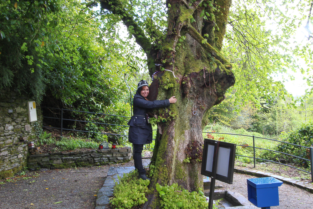
Tree at St. Gobnait’s Holy Well – Ballyvourney, Co. Cork
The connection between the eternal world and the physical is nearly unidentifiable in a place of resurrection – as they are knitted together in an inextricable pattern where neither can be separated from the other. The place of resurrection then is unto itself the combination of both worlds particularly suited to that specific spirit. … and Ballyvourney was St. Gobnait’s place.
What is yours?
